Author: John Bartholomew
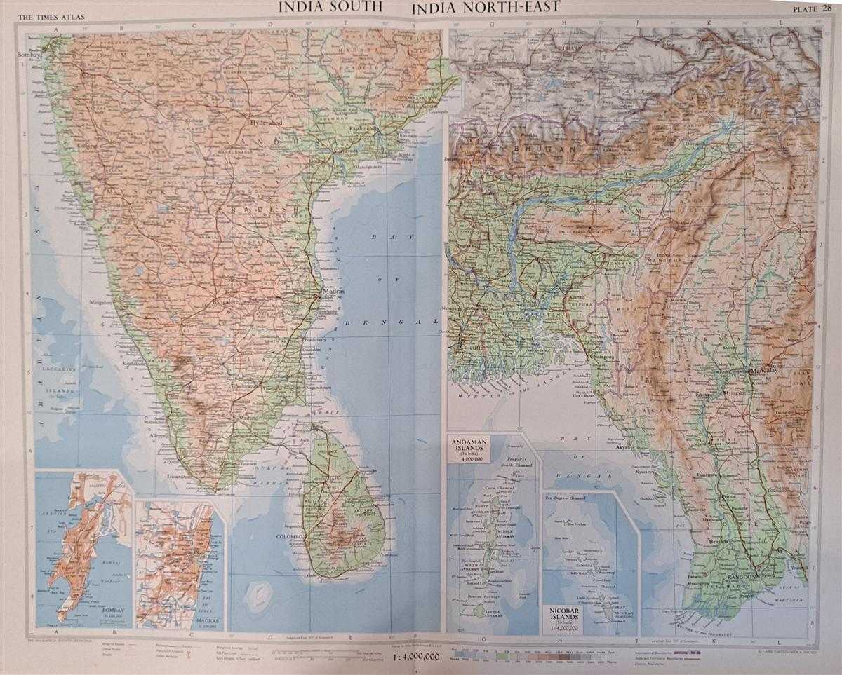
Title: Map of 'India South and India North-East', Plate 28 disbound from 1959 Mid-Century Times Atlas of the World, Volume II, (South-West Asia and Russia) includes India, East Pakistan, Ceylon, Andaman Islands, Nicobar Islands
Description: The Times Publishing Company Ltd. London, 1959. Mid-Century Edition, Softcover. Fine Condition/No Dust Jacket. Single disbound map sheet from 'The Times Atlas of the World, Mid-Century Edition; Volume II Eurasia, suitable for framing. Map is in colour and has vertical centre fold. Approx. sheet size is 49 x 61cm. Sheet is clean, bright and crisp. Scale 1:4,000,000. Map shows relief, national and other boundaries, cities, town, rivers main roads, some tracks, railways, oil pipe lines, mangrove Swamps, main civil airports and other airfields etc. Inset maps of Andaman Island and Nicobar Island at 1:4,000,000 scale. Inset plans of Bombay and Madras showing main roads, green areas, railways etc. at 1:200,000 scale First printing of this edition. Quantity Available: 1. Shipped Weight: under 1 kg. Pictures of this item not already displayed here available upon request. Inventory No: 45022081062. ISBN: 0333371852
Keywords: BZDB4 Maps; Geology, geography, mineralogy, environment; Indian sub-continent & South East Asia. Unbranded John Bartholomew Map of 'India South and India North-East', Plate 28 disbound from 1959 Mid-Century Times Atlas of the World, Volume II, (South-West
See more books from our catalog: Maps
Title: Map of 'India South and India North-East', Plate 28 disbound from 1959 Mid-Century Times Atlas of the World, Volume II, (South-West Asia and Russia) includes India, East Pakistan, Ceylon, Andaman Islands, Nicobar Islands
Description: The Times Publishing Company Ltd. London, 1959. Mid-Century Edition, Softcover. Fine Condition/No Dust Jacket. Single disbound map sheet from 'The Times Atlas of the World, Mid-Century Edition; Volume II Eurasia, suitable for framing. Map is in colour and has vertical centre fold. Approx. sheet size is 49 x 61cm. Sheet is clean, bright and crisp. Scale 1:4,000,000. Map shows relief, national and other boundaries, cities, town, rivers main roads, some tracks, railways, oil pipe lines, mangrove Swamps, main civil airports and other airfields etc. Inset maps of Andaman Island and Nicobar Island at 1:4,000,000 scale. Inset plans of Bombay and Madras showing main roads, green areas, railways etc. at 1:200,000 scale First printing of this edition. Quantity Available: 1. Shipped Weight: under 1 kg. Pictures of this item not already displayed here available upon request. Inventory No: 45022081062. ISBN: 0333371852
Keywords: BZDB4 Maps; Geology, geography, mineralogy, environment; Indian sub-continent & South East Asia. Unbranded John Bartholomew Map of 'India South and India North-East', Plate 28 disbound from 1959 Mid-Century Times Atlas of the World, Volume II, (South-West
Price: GBP 28.00 = appr. US$ 39.98 Seller: Bailgate Books Ltd
- Book number: 45022081062
- Book number: 45022081062
See more books from our catalog: Maps