Author: John Bartholomew
Title: Map of Japan - Plate 19 disbound from 1958 Mid-Century Times Atlas of the World, with Iwo Jima and Okinawa and inset plan of Tokyo Bay
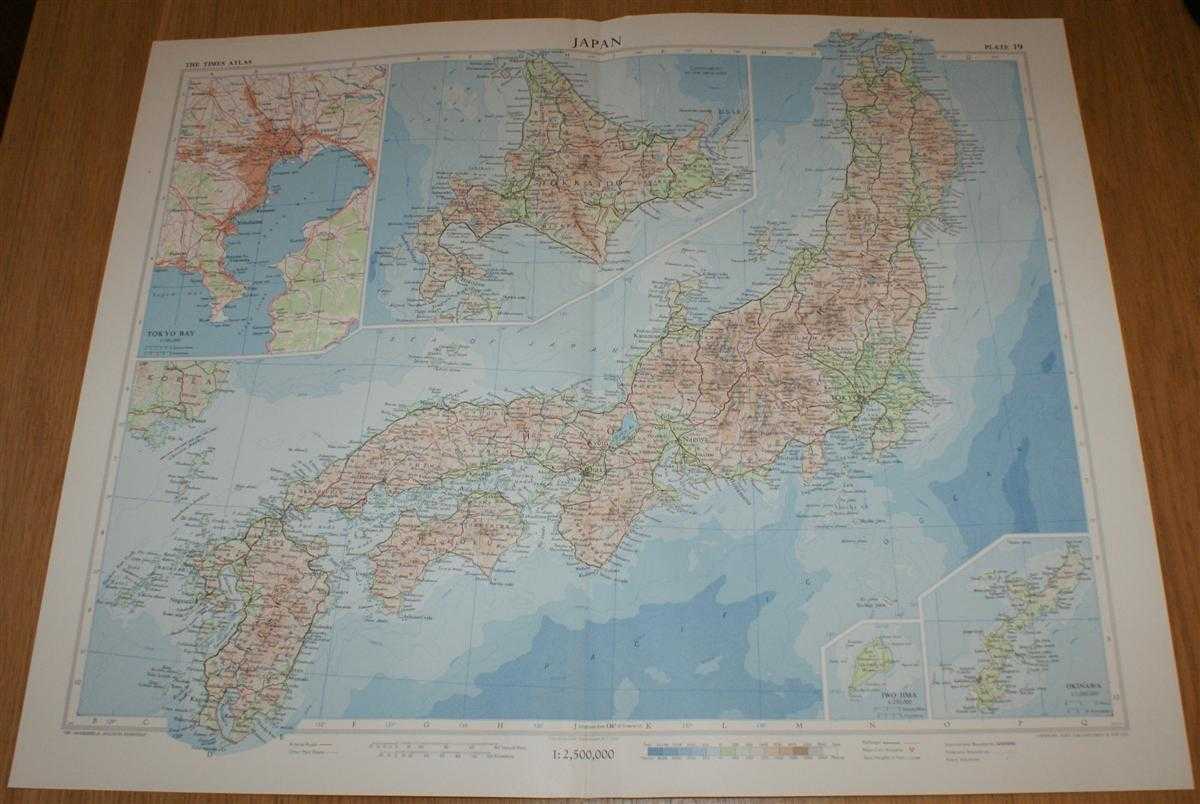
Description: The Times Publishing Company Ltd. London, 1958. Mid-Century Edition, Softcover. Very Good Condition/No Dust Jacket. Single disbound map sheet from 'The Times Atlas of the World, Mid-Century Edition; Volume I The World, Australia & East Asia' suitable for framing. Map is in colour and has vertical centre fold. Approx sheet size is 49 x 61cm. Sheet is clean, bright and crisp. Map covers Japan, with Hokkaido included as an inset contiuation panel. Sheet contains small inset plans showing Iwo Jima and Okinawa at closer scales and a plan of Tokyo Bay (including Tokyo, Yokohama, Kawasaki, Yokosuka and Chiba). Road and railway routes are shown. First printing of this edition. Quantity Available: 1. Shipped Weight: under 1 kg. Pictures of this item not already displayed here available upon request. Inventory No: 45021024043. ISBN: 0718132130
Keywords: BZDB4 Maps; Geology, geography, mineralogy, environment; China, Japan, Nepal & Tibet. John Bartholomew Map of Japan - Plate 19 disbound from 1958 Mid-Century Times Atlas of the World, with Iwo Jima and Okinawa and inset plan of Tokyo Bay Geology, geograph
See more books from our catalog: Maps
Title: Map of Japan - Plate 19 disbound from 1958 Mid-Century Times Atlas of the World, with Iwo Jima and Okinawa and inset plan of Tokyo Bay
Description: The Times Publishing Company Ltd. London, 1958. Mid-Century Edition, Softcover. Very Good Condition/No Dust Jacket. Single disbound map sheet from 'The Times Atlas of the World, Mid-Century Edition; Volume I The World, Australia & East Asia' suitable for framing. Map is in colour and has vertical centre fold. Approx sheet size is 49 x 61cm. Sheet is clean, bright and crisp. Map covers Japan, with Hokkaido included as an inset contiuation panel. Sheet contains small inset plans showing Iwo Jima and Okinawa at closer scales and a plan of Tokyo Bay (including Tokyo, Yokohama, Kawasaki, Yokosuka and Chiba). Road and railway routes are shown. First printing of this edition. Quantity Available: 1. Shipped Weight: under 1 kg. Pictures of this item not already displayed here available upon request. Inventory No: 45021024043. ISBN: 0718132130
Keywords: BZDB4 Maps; Geology, geography, mineralogy, environment; China, Japan, Nepal & Tibet. John Bartholomew Map of Japan - Plate 19 disbound from 1958 Mid-Century Times Atlas of the World, with Iwo Jima and Okinawa and inset plan of Tokyo Bay Geology, geograph
Price: GBP 26.00 = appr. US$ 37.13 Seller: Bailgate Books Ltd
- Book number: 45021024043
- Book number: 45021024043
See more books from our catalog: Maps