Author: John Bartholomew
Title: Map of 'China and West Pacific' - Plate 16 disbound from 1958 Mid-Century Times Atlas of the World, including Korea, Japan, Philippines, Indonesia and Indo-China
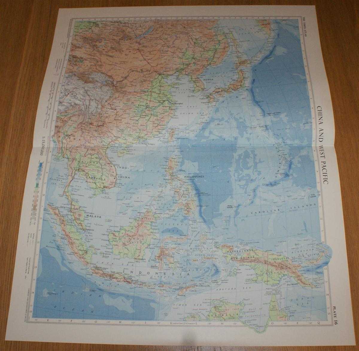
Description: The Times Publishing Company Ltd. London, 1958. Mid-Century Edition, Softcover. Very Good Condition/No Dust Jacket. Single disbound map sheet from 'The Times Atlas of the World, Mid-Century Edition; Volume I The World, Australia & East Asia' suitable for framing. Map is in colour and has horizontal centre fold. Approx sheet size is 61 x 49cm. Sheet is clean, bright and crisp. Sheet covers China, Mongolia, Korea, Japan, Taiwan, Thailand, Cambodia, Laos, Malaya, Philippines, Indonesia, Borneo, Celebes, New Guinea, Caroline Islands, Bismarck Archipelago, South China Sea, Yellow Sea, Java Sea, etc. First printing of this edition. Quantity Available: 1. Shipped Weight: under 1 kg. Pictures of this item not already displayed here available upon request. Inventory No: 45021024040. ISBN: 0718132130
Keywords: BZDB4 Maps; Indian sub-continent & South East Asia; Australasia and the Pacific; China, Japan, Nepal & Tibet. John Bartholomew Map of 'China and West Pacific' - Plate 16 disbound from 1958 Mid-Century Times Atlas of the World, including Korea, Japan, Phil
See more books from our catalog: Maps
Title: Map of 'China and West Pacific' - Plate 16 disbound from 1958 Mid-Century Times Atlas of the World, including Korea, Japan, Philippines, Indonesia and Indo-China
Description: The Times Publishing Company Ltd. London, 1958. Mid-Century Edition, Softcover. Very Good Condition/No Dust Jacket. Single disbound map sheet from 'The Times Atlas of the World, Mid-Century Edition; Volume I The World, Australia & East Asia' suitable for framing. Map is in colour and has horizontal centre fold. Approx sheet size is 61 x 49cm. Sheet is clean, bright and crisp. Sheet covers China, Mongolia, Korea, Japan, Taiwan, Thailand, Cambodia, Laos, Malaya, Philippines, Indonesia, Borneo, Celebes, New Guinea, Caroline Islands, Bismarck Archipelago, South China Sea, Yellow Sea, Java Sea, etc. First printing of this edition. Quantity Available: 1. Shipped Weight: under 1 kg. Pictures of this item not already displayed here available upon request. Inventory No: 45021024040. ISBN: 0718132130
Keywords: BZDB4 Maps; Indian sub-continent & South East Asia; Australasia and the Pacific; China, Japan, Nepal & Tibet. John Bartholomew Map of 'China and West Pacific' - Plate 16 disbound from 1958 Mid-Century Times Atlas of the World, including Korea, Japan, Phil
Price: GBP 26.00 = appr. US$ 37.13 Seller: Bailgate Books Ltd
- Book number: 45021024040
- Book number: 45021024040
See more books from our catalog: Maps