Author: John Bartholomew
Title: Map of New Guinea and the Solomon Islands - Plate 15 disbound from 1958 Mid-Century Times Atlas of the World
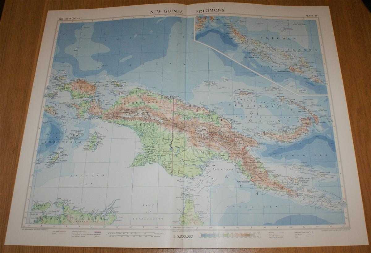
Description: The Times Publishing Company Ltd. London, 1958. Mid-Century Edition, Softcover. Very Good Condition/No Dust Jacket. Single disbound map sheet from 'The Times Atlas of the World, Mid-Century Edition; Volume I The World, Australia & East Asia' suitable for framing. Map is in colour and has vertical centre fold. Approx sheet size is 49 x 61cm. Sheet is clean, bright and crisp. Sheet covers New Guinea (Papua New Guinea), Netherlands New Guinea, Bismark Archipelago, Admiralty Islands, New Ireland, New Britain, D'Entrecasteaux Islands, Solomon Islands, New Georgia Group, Kepulauan Aru and Kepulauan Tanimbar. Solomon Islands are included as a continuation panel in the top right of sheet at same scale. First printing of this edition. Quantity Available: 1. Shipped Weight: under 1 kg. Pictures of this item not already displayed here available upon request. Inventory No: 45021024039. ISBN: 0718132130
Keywords: BZDB4 Maps; Geology, geography, mineralogy, environment; Australasia and the Pacific. John Bartholomew Map of New Guinea and the Solomon Islands - Plate 15 disbound from 1958 Mid-Century Times Atlas of the World Geology, geography, mineralogy, environment
See more books from our catalog: Maps
Title: Map of New Guinea and the Solomon Islands - Plate 15 disbound from 1958 Mid-Century Times Atlas of the World
Description: The Times Publishing Company Ltd. London, 1958. Mid-Century Edition, Softcover. Very Good Condition/No Dust Jacket. Single disbound map sheet from 'The Times Atlas of the World, Mid-Century Edition; Volume I The World, Australia & East Asia' suitable for framing. Map is in colour and has vertical centre fold. Approx sheet size is 49 x 61cm. Sheet is clean, bright and crisp. Sheet covers New Guinea (Papua New Guinea), Netherlands New Guinea, Bismark Archipelago, Admiralty Islands, New Ireland, New Britain, D'Entrecasteaux Islands, Solomon Islands, New Georgia Group, Kepulauan Aru and Kepulauan Tanimbar. Solomon Islands are included as a continuation panel in the top right of sheet at same scale. First printing of this edition. Quantity Available: 1. Shipped Weight: under 1 kg. Pictures of this item not already displayed here available upon request. Inventory No: 45021024039. ISBN: 0718132130
Keywords: BZDB4 Maps; Geology, geography, mineralogy, environment; Australasia and the Pacific. John Bartholomew Map of New Guinea and the Solomon Islands - Plate 15 disbound from 1958 Mid-Century Times Atlas of the World Geology, geography, mineralogy, environment
Price: GBP 26.00 = appr. US$ 37.13 Seller: Bailgate Books Ltd
- Book number: 45021024039
- Book number: 45021024039
See more books from our catalog: Maps