Author: John Bartholomew
Title: Map of 'Australia West' - Plate 14 disbound from 1958 Mid-Century Times Atlas of the World, covering Western Australia with inset plan of Perth
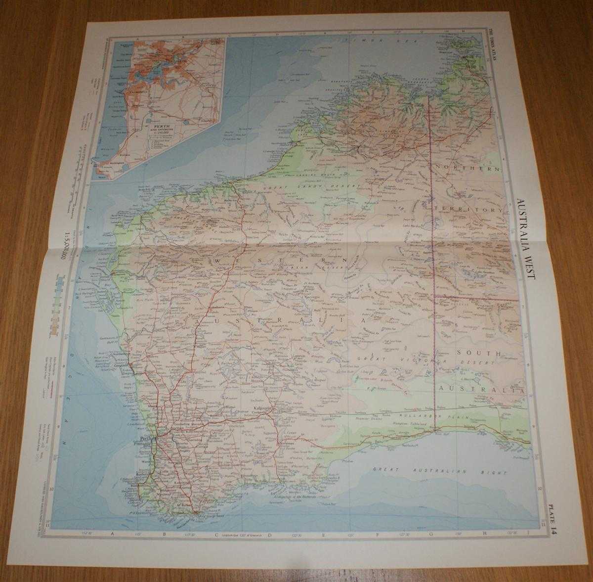
Description: The Times Publishing Company Ltd. London, 1958. Mid-Century Edition, Softcover. Very Good Condition/No Dust Jacket. Single disbound map sheet from 'The Times Atlas of the World, Mid-Century Edition; Volume I The World, Australia & East Asia' suitable for framing. Map is in colour and has horizontal centre fold. Approx sheet size is 61 x 49cm. Sheet is clean, bright and crisp. Sheet covers Western Australia and includes Perth, Bonaparte Archipelago, Kalgoorlie, Shark Bay, Nullarbor Plain, Darwin and Ayers Rock. Sheet also contains inset plan at closer scale showing Perth and Freemantle. Roads and rail routes are shown. First printing of this edition. Quantity Available: 1. Shipped Weight: under 1 kg. Pictures of this item not already displayed here available upon request. Inventory No: 45021024038. ISBN: 0718132130
Keywords: BZDB4 Maps; Geology, geography, mineralogy, environment; Australasia and the Pacific. John Bartholomew Map of 'Australia West' - Plate 14 disbound from 1958 Mid-Century Times Atlas of the World, covering Western Australia with inset plan of Perth Geology,
See more books from our catalog: Maps
Title: Map of 'Australia West' - Plate 14 disbound from 1958 Mid-Century Times Atlas of the World, covering Western Australia with inset plan of Perth
Description: The Times Publishing Company Ltd. London, 1958. Mid-Century Edition, Softcover. Very Good Condition/No Dust Jacket. Single disbound map sheet from 'The Times Atlas of the World, Mid-Century Edition; Volume I The World, Australia & East Asia' suitable for framing. Map is in colour and has horizontal centre fold. Approx sheet size is 61 x 49cm. Sheet is clean, bright and crisp. Sheet covers Western Australia and includes Perth, Bonaparte Archipelago, Kalgoorlie, Shark Bay, Nullarbor Plain, Darwin and Ayers Rock. Sheet also contains inset plan at closer scale showing Perth and Freemantle. Roads and rail routes are shown. First printing of this edition. Quantity Available: 1. Shipped Weight: under 1 kg. Pictures of this item not already displayed here available upon request. Inventory No: 45021024038. ISBN: 0718132130
Keywords: BZDB4 Maps; Geology, geography, mineralogy, environment; Australasia and the Pacific. John Bartholomew Map of 'Australia West' - Plate 14 disbound from 1958 Mid-Century Times Atlas of the World, covering Western Australia with inset plan of Perth Geology,
Price: GBP 26.00 = appr. US$ 37.13 Seller: Bailgate Books Ltd
- Book number: 45021024038
- Book number: 45021024038
See more books from our catalog: Maps