Author: John Bartholomew
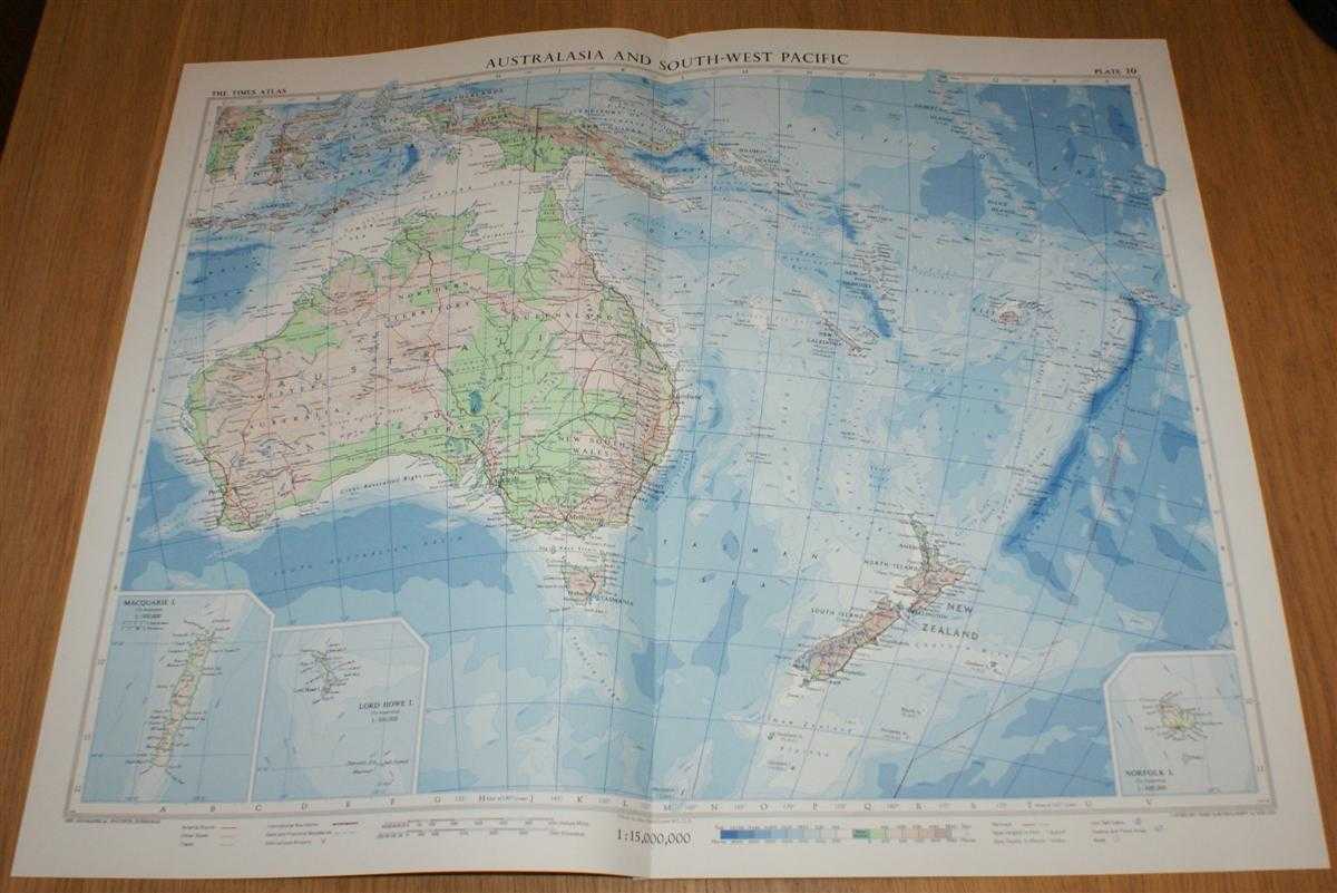
Title: Map of Australasia and the South-West Pacific - Plate 10 disbound from 1958 Mid-Century Times Atlas of the World including Australia, New Zealand, New Guinea, Fiji, etc. (on Bonne Projection)
Description: The Times Publishing Company Ltd. London, 1958. Mid-Century Edition, Softcover. Very Good Condition/No Dust Jacket. Single disbound map sheet from 'The Times Atlas of the World, Mid-Century Edition; Volume I The World, Australia & East Asia' suitable for framing. Map is in colour and has vertical centre fold. Approx sheet size is 49 x 61cm. Sheet is clean, bright and crisp. Sheet covers Australia, New Zealand, New Guinea, Fiji, New Caledonia, Samoa, Tonga, New Hebrides, Solomon Islands, Timor, Celebes, etc. and includes three small inset maps showing Norfolk Island, Lord Howe Island and Macquarie Island at closer scale. First printing of this edition. Quantity Available: 1. Shipped Weight: under 1 kg. Pictures of this item not already displayed here available upon request. Inventory No: 45021024034. ISBN: 0718132130
Keywords: BZDB4 Maps; Geology, geography, mineralogy, environment; Australasia and the Pacific. John Bartholomew Map of Australasia and the South-West Pacific - Plate 10 disbound from 1958 Mid-Century Times Atlas of the World including Australia, New Zealand, New G
See more books from our catalog: Maps
Title: Map of Australasia and the South-West Pacific - Plate 10 disbound from 1958 Mid-Century Times Atlas of the World including Australia, New Zealand, New Guinea, Fiji, etc. (on Bonne Projection)
Description: The Times Publishing Company Ltd. London, 1958. Mid-Century Edition, Softcover. Very Good Condition/No Dust Jacket. Single disbound map sheet from 'The Times Atlas of the World, Mid-Century Edition; Volume I The World, Australia & East Asia' suitable for framing. Map is in colour and has vertical centre fold. Approx sheet size is 49 x 61cm. Sheet is clean, bright and crisp. Sheet covers Australia, New Zealand, New Guinea, Fiji, New Caledonia, Samoa, Tonga, New Hebrides, Solomon Islands, Timor, Celebes, etc. and includes three small inset maps showing Norfolk Island, Lord Howe Island and Macquarie Island at closer scale. First printing of this edition. Quantity Available: 1. Shipped Weight: under 1 kg. Pictures of this item not already displayed here available upon request. Inventory No: 45021024034. ISBN: 0718132130
Keywords: BZDB4 Maps; Geology, geography, mineralogy, environment; Australasia and the Pacific. John Bartholomew Map of Australasia and the South-West Pacific - Plate 10 disbound from 1958 Mid-Century Times Atlas of the World including Australia, New Zealand, New G
Price: GBP 28.00 = appr. US$ 39.98 Seller: Bailgate Books Ltd
- Book number: 45021024034
- Book number: 45021024034
See more books from our catalog: Maps