Author: John Bartholomew
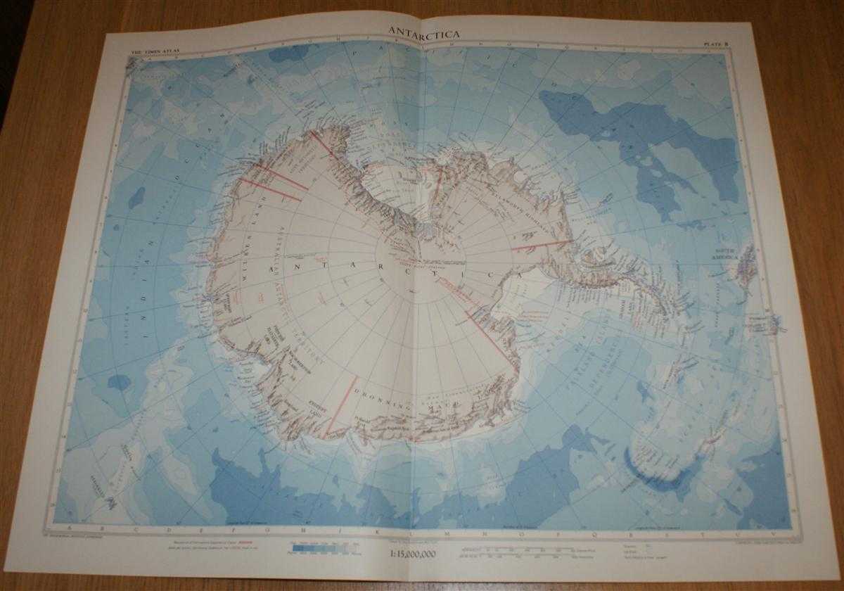
Title: Map of Antarctica - Plate 8 disbound from 1958 Mid-Century Times Atlas of the World using Zenithal Equidistant Projection
Description: The Times Publishing Company Ltd. London, 1958. Mid-Century Edition, Softcover. Very Good Condition/No Dust Jacket. Single disbound map sheet from 'The Times Atlas of the World, Mid-Century Edition; Volume I The World, Australia & East Asia' suitable for framing. Map is in colour and has vertical centre fold. Approx sheet size is 49 x 61cm. Sheet is clean, bright and crisp. Map covers whole of Antarctica and includes Cape Horn, Falkland Islands, Kerguelen Island, South Orkney, South Georgia, South Sandwich Islands, Hobart, South Pole, Ross Ice Sheet, Filchner Ice Sheet, etc. First printing of this edition. Quantity Available: 1. Shipped Weight: under 1 kg. Pictures of this item not already displayed here available upon request. Inventory No: 45021024032. ISBN: 0718132130
Keywords: BZDB4 Maps; Geology, geography, mineralogy, environment; Arctic & Antarctic. John Bartholomew Map of Antarctica - Plate 8 disbound from 1958 Mid-Century Times Atlas of the World using Zenithal Equidistant Projection Geology, geography, mineralogy, environ
See more books from our catalog: Maps
Title: Map of Antarctica - Plate 8 disbound from 1958 Mid-Century Times Atlas of the World using Zenithal Equidistant Projection
Description: The Times Publishing Company Ltd. London, 1958. Mid-Century Edition, Softcover. Very Good Condition/No Dust Jacket. Single disbound map sheet from 'The Times Atlas of the World, Mid-Century Edition; Volume I The World, Australia & East Asia' suitable for framing. Map is in colour and has vertical centre fold. Approx sheet size is 49 x 61cm. Sheet is clean, bright and crisp. Map covers whole of Antarctica and includes Cape Horn, Falkland Islands, Kerguelen Island, South Orkney, South Georgia, South Sandwich Islands, Hobart, South Pole, Ross Ice Sheet, Filchner Ice Sheet, etc. First printing of this edition. Quantity Available: 1. Shipped Weight: under 1 kg. Pictures of this item not already displayed here available upon request. Inventory No: 45021024032. ISBN: 0718132130
Keywords: BZDB4 Maps; Geology, geography, mineralogy, environment; Arctic & Antarctic. John Bartholomew Map of Antarctica - Plate 8 disbound from 1958 Mid-Century Times Atlas of the World using Zenithal Equidistant Projection Geology, geography, mineralogy, environ
Price: GBP 28.00 = appr. US$ 39.98 Seller: Bailgate Books Ltd
- Book number: 45021024032
- Book number: 45021024032
See more books from our catalog: Maps