Author: John Bartholomew
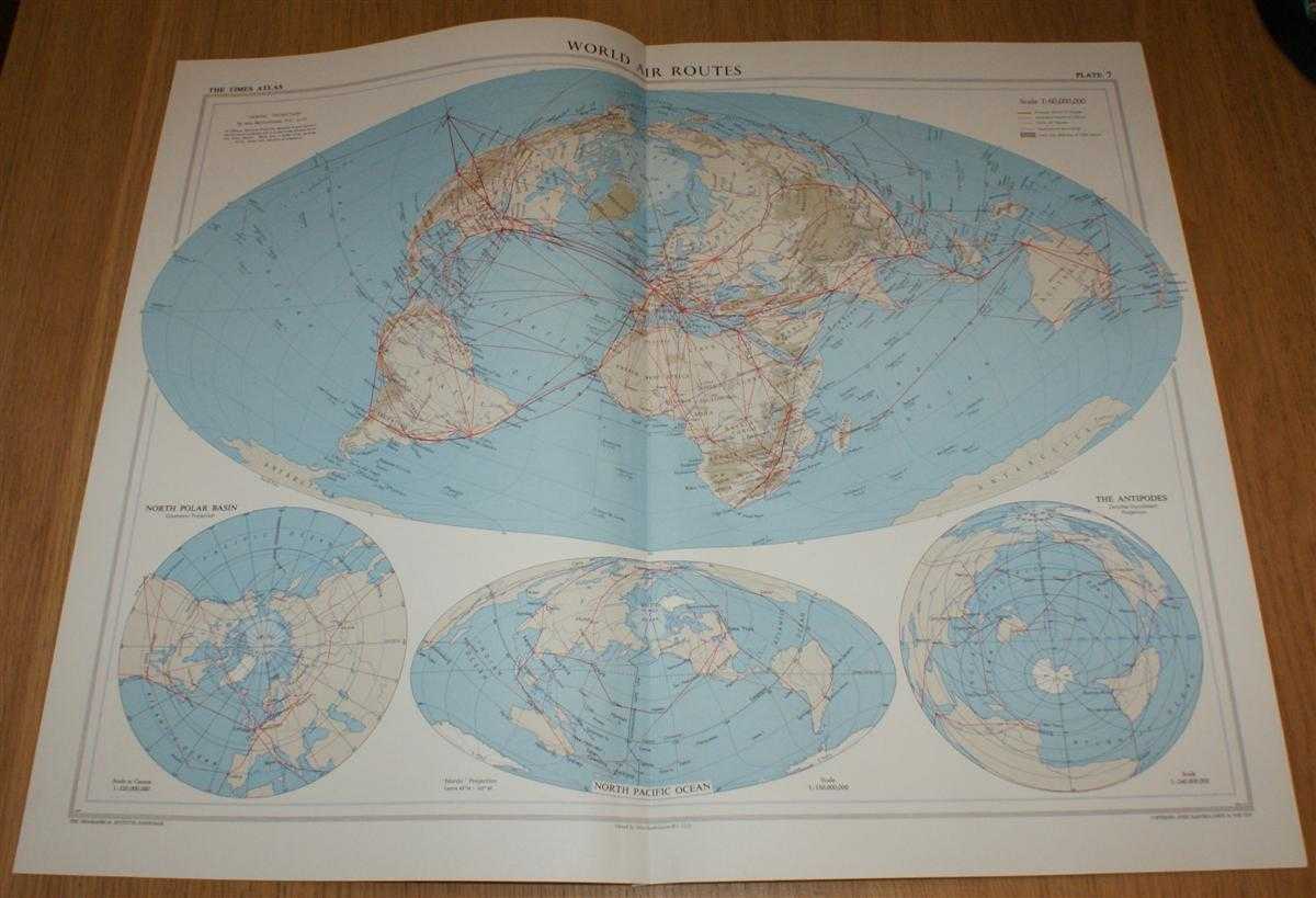
Title: Map showing 'World Air Routes' - Plate 7 disbound from 1958 Mid-Century Times Atlas of the World using Bartholomew's 'Nordic' Projection
Description: The Times Publishing Company Ltd. London, 1958. Mid-Century Edition, Softcover. Very Good Condition/No Dust Jacket. Single disbound map sheet from 'The Times Atlas of the World, Mid-Century Edition; Volume I The World, Australia & East Asia' suitable for framing. Map is in colour and has vertical centre fold. Approx sheet size is 49 x 61cm. Sheet is clean, bright and crisp. Sheet contains four projections or views, one larger and three smaller, of the world and shows Principal and Secondary World Air (aviation) Routes. The three smaller maps show views of North Polar Basin, North Pacific Ocean and The Antipodes. First printing of this edition. Quantity Available: 1. Shipped Weight: under 1 kg. Pictures of this item not already displayed here available upon request. Inventory No: 45021024031. ISBN: 0718132130
Keywords: BZDB4 Maps; Geology, geography, mineralogy, environment; World History; Aviation, aircraft. John Bartholomew Map showing 'World Air Routes' - Plate 7 disbound from 1958 Mid-Century Times Atlas of the World using Bartholomew's 'Nordic' Projection Geology,
See more books from our catalog: Maps
Title: Map showing 'World Air Routes' - Plate 7 disbound from 1958 Mid-Century Times Atlas of the World using Bartholomew's 'Nordic' Projection
Description: The Times Publishing Company Ltd. London, 1958. Mid-Century Edition, Softcover. Very Good Condition/No Dust Jacket. Single disbound map sheet from 'The Times Atlas of the World, Mid-Century Edition; Volume I The World, Australia & East Asia' suitable for framing. Map is in colour and has vertical centre fold. Approx sheet size is 49 x 61cm. Sheet is clean, bright and crisp. Sheet contains four projections or views, one larger and three smaller, of the world and shows Principal and Secondary World Air (aviation) Routes. The three smaller maps show views of North Polar Basin, North Pacific Ocean and The Antipodes. First printing of this edition. Quantity Available: 1. Shipped Weight: under 1 kg. Pictures of this item not already displayed here available upon request. Inventory No: 45021024031. ISBN: 0718132130
Keywords: BZDB4 Maps; Geology, geography, mineralogy, environment; World History; Aviation, aircraft. John Bartholomew Map showing 'World Air Routes' - Plate 7 disbound from 1958 Mid-Century Times Atlas of the World using Bartholomew's 'Nordic' Projection Geology,
Price: GBP 25.00 = appr. US$ 35.70 Seller: Bailgate Books Ltd
- Book number: 45021024031
- Book number: 45021024031
See more books from our catalog: Maps