Author: John Bartholomew
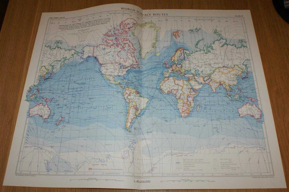
Title: Map showing 'World Surface Routes' - Plate 6 disbound from 1958 Mid-Century Times Atlas of the World showing Ocean Currents, Transport Routes and Standard Time Differences across the World
Description: The Times Publishing Company Ltd. London, 1958. Mid-Century Edition, Softcover. Very Good Condition/No Dust Jacket. Single disbound map sheet from 'The Times Atlas of the World, Mid-Century Edition; Volume I The World, Australia & East Asia' suitable for framing. Map is in colour and has vertical centre fold. Approx sheet size is 49 x 61cm. Sheet is clean, bright and crisp. Map includes Ocean Currents (warm and cold), Principal Shipping and Railway Routes, Transcontinental Roads, Degrees of Magnetic Declination, Drift and Pack-Ice Limits and Standard Time Differences across the World. First printing of this edition. Quantity Available: 1. Shipped Weight: under 1 kg. Pictures of this item not already displayed here available upon request. Inventory No: 45021024030. ISBN: 0718132130
Keywords: BZDB4 Maps; Horology - clocks and watches; naval, naval history, maritime, ships, boats; Geology, geography, mineralogy, environment. John Bartholomew Map showing 'World Surface Routes' - Plate 6 disbound from 1958 Mid-Century Times Atlas of the World sho
See more books from our catalog: Maps
Title: Map showing 'World Surface Routes' - Plate 6 disbound from 1958 Mid-Century Times Atlas of the World showing Ocean Currents, Transport Routes and Standard Time Differences across the World
Description: The Times Publishing Company Ltd. London, 1958. Mid-Century Edition, Softcover. Very Good Condition/No Dust Jacket. Single disbound map sheet from 'The Times Atlas of the World, Mid-Century Edition; Volume I The World, Australia & East Asia' suitable for framing. Map is in colour and has vertical centre fold. Approx sheet size is 49 x 61cm. Sheet is clean, bright and crisp. Map includes Ocean Currents (warm and cold), Principal Shipping and Railway Routes, Transcontinental Roads, Degrees of Magnetic Declination, Drift and Pack-Ice Limits and Standard Time Differences across the World. First printing of this edition. Quantity Available: 1. Shipped Weight: under 1 kg. Pictures of this item not already displayed here available upon request. Inventory No: 45021024030. ISBN: 0718132130
Keywords: BZDB4 Maps; Horology - clocks and watches; naval, naval history, maritime, ships, boats; Geology, geography, mineralogy, environment. John Bartholomew Map showing 'World Surface Routes' - Plate 6 disbound from 1958 Mid-Century Times Atlas of the World sho
Price: GBP 25.00 = appr. US$ 35.70 Seller: Bailgate Books Ltd
- Book number: 45021024030
- Book number: 45021024030
See more books from our catalog: Maps