Author: John Bartholomew
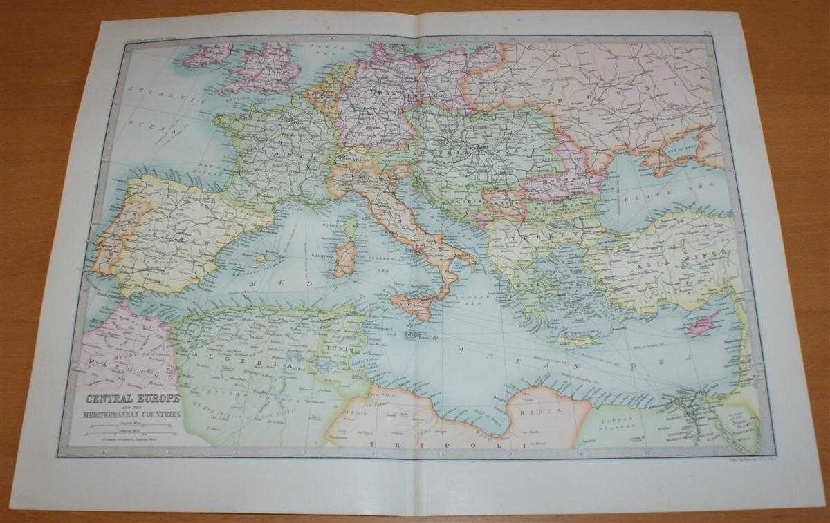
Title: Map of 'Central Europe and Mediterranean' - Sheet 28 disbound from the 1890 'The Library Reference Atlas of the World' with Spain, France, Italy, Sicily, Sardinia, Malta, Austria-Hungary, Turkey, Greece, Crete, Cyprys, etc.
Description: Macmillan and Co. London, 1890. First Edition, Softcover. Very Good Condition/No Dust Jacket. Single disbound coloured map sheet, from John Bartholomew's Library Reference Atlas. Suitable for framing. Approx size 35 x 46cm, vertical centre fold. Map is clean, crisp and bright, occasional foxing in margins. Map covers Central Europe and the Mediterranean Sea with Spain, France, Italy, Sicily, Sardinia, Malta, Austria-Hungary, Turkey, Greece, Crete, Cyprys, Tunis, Gibralter, Bosnia, Servia, Bulgaria, Roumania, Switzerland, German Empire, Belguim, Holland, Portugal, Balearic Islands, Adriatic Sea, Agean Sea, and parts of England, Russia, Asia Minor, Egypt, Tripoli (Libya), Algeria and Marocco. No dust jacket, as published. Quantity Available: 1. Shipped Weight: under 1 kg. Pictures of this item not already displayed here available upon request. Inventory No: 45021014047. ISBN: 0718132130
Keywords: BZDB4 Maps; Italy; Middle-East, Turkey, Greece, Cyprus & Egypt; European History. John Bartholomew Map of 'Central Europe and Mediterranean' - Sheet 28 disbound from the 1890 'The Library Reference Atlas of the World' with Spain, France, Italy, Sicily, Sa
See more books from our catalog: Maps
Title: Map of 'Central Europe and Mediterranean' - Sheet 28 disbound from the 1890 'The Library Reference Atlas of the World' with Spain, France, Italy, Sicily, Sardinia, Malta, Austria-Hungary, Turkey, Greece, Crete, Cyprys, etc.
Description: Macmillan and Co. London, 1890. First Edition, Softcover. Very Good Condition/No Dust Jacket. Single disbound coloured map sheet, from John Bartholomew's Library Reference Atlas. Suitable for framing. Approx size 35 x 46cm, vertical centre fold. Map is clean, crisp and bright, occasional foxing in margins. Map covers Central Europe and the Mediterranean Sea with Spain, France, Italy, Sicily, Sardinia, Malta, Austria-Hungary, Turkey, Greece, Crete, Cyprys, Tunis, Gibralter, Bosnia, Servia, Bulgaria, Roumania, Switzerland, German Empire, Belguim, Holland, Portugal, Balearic Islands, Adriatic Sea, Agean Sea, and parts of England, Russia, Asia Minor, Egypt, Tripoli (Libya), Algeria and Marocco. No dust jacket, as published. Quantity Available: 1. Shipped Weight: under 1 kg. Pictures of this item not already displayed here available upon request. Inventory No: 45021014047. ISBN: 0718132130
Keywords: BZDB4 Maps; Italy; Middle-East, Turkey, Greece, Cyprus & Egypt; European History. John Bartholomew Map of 'Central Europe and Mediterranean' - Sheet 28 disbound from the 1890 'The Library Reference Atlas of the World' with Spain, France, Italy, Sicily, Sa
Price: GBP 34.00 = appr. US$ 48.55 Seller: Bailgate Books Ltd
- Book number: 45021014047
- Book number: 45021014047
See more books from our catalog: Maps