Author: John Bartholomew
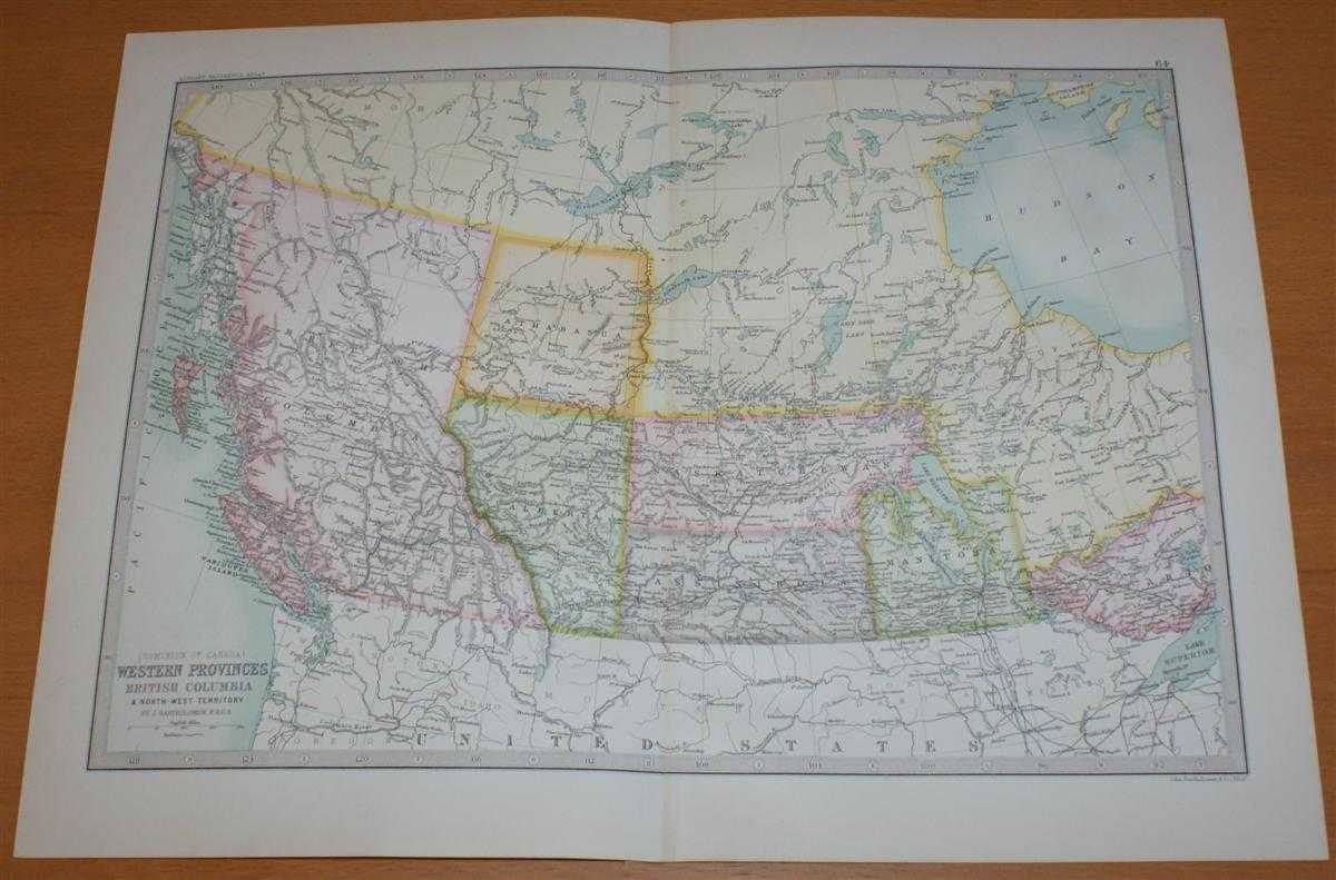
Title: Map of 'Dominion of Canada - Western Provinces, British Colombia and North-West Territory' - Sheet 64 disbound from the 1890 'The Library Reference Atlas of the World' with Athabasca, Alberta, Saskatchewan, Assinibola and Manitoba
Description: Macmillan and Co. London, 1890. First Edition, Softcover. Very Good Condition/No Dust Jacket. Single disbound coloured map sheet, from John Bartholomew's Library Reference Atlas. Suitable for framing. Approx size 35 x 46cm, vertical centre fold. Occasional light foxing in margin and at fold, map is otherwise clean, crisp and bright, Map covers part Canada, with British Colombia, Athabasca, Alberta, Saskatchewan, Assinibola, Manitoba and the southern part of the North West Territories. Provinces are shown using various pastel colours, bordering USA is mapped but not coloured. Map includes Chesterfiled Inlet, Great Slave Lake, Rein Deer Lake, Rocky Mountains, Lake Winnipeg, Vancouver Island and Queen Charlotte Islands. No dust jacket, as published. Quantity Available: 1. Shipped Weight: under 1 kg. Pictures of this item not already displayed here available upon request. Inventory No: 45021014046. ISBN: 0718132130
Keywords: BZDB4 Maps; World History; Geology, geography, mineralogy, environment; USA & Canada. John Bartholomew Map of 'Dominion of Canada - Western Provinces, British Colombia and North-West Territory' - Sheet 64 disbound from the 1890 'The Library Reference Atla
See more books from our catalog: Maps
Title: Map of 'Dominion of Canada - Western Provinces, British Colombia and North-West Territory' - Sheet 64 disbound from the 1890 'The Library Reference Atlas of the World' with Athabasca, Alberta, Saskatchewan, Assinibola and Manitoba
Description: Macmillan and Co. London, 1890. First Edition, Softcover. Very Good Condition/No Dust Jacket. Single disbound coloured map sheet, from John Bartholomew's Library Reference Atlas. Suitable for framing. Approx size 35 x 46cm, vertical centre fold. Occasional light foxing in margin and at fold, map is otherwise clean, crisp and bright, Map covers part Canada, with British Colombia, Athabasca, Alberta, Saskatchewan, Assinibola, Manitoba and the southern part of the North West Territories. Provinces are shown using various pastel colours, bordering USA is mapped but not coloured. Map includes Chesterfiled Inlet, Great Slave Lake, Rein Deer Lake, Rocky Mountains, Lake Winnipeg, Vancouver Island and Queen Charlotte Islands. No dust jacket, as published. Quantity Available: 1. Shipped Weight: under 1 kg. Pictures of this item not already displayed here available upon request. Inventory No: 45021014046. ISBN: 0718132130
Keywords: BZDB4 Maps; World History; Geology, geography, mineralogy, environment; USA & Canada. John Bartholomew Map of 'Dominion of Canada - Western Provinces, British Colombia and North-West Territory' - Sheet 64 disbound from the 1890 'The Library Reference Atla
Price: GBP 35.00 = appr. US$ 49.98 Seller: Bailgate Books Ltd
- Book number: 45021014046
- Book number: 45021014046
See more books from our catalog: Maps