Author: John Bartholomew
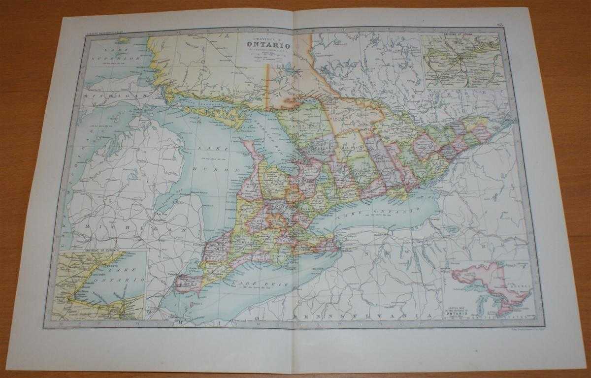
Title: Map of 'Province of Ontario' - Sheet 63 disbound from the 1890 'The Library Reference Atlas of the World' with inset panels showing Environs of Toronto and Ottawa
Description: Macmillan and Co. London, 1890. First Edition, Softcover. Very Good Condition/No Dust Jacket. Single disbound coloured map sheet, from John Bartholomew's Library Reference Atlas. Suitable for framing. Approx size 35 x 46cm, vertical centre fold. Map is clean, crisp and bright, occasional light foxing in margin. Map covers part of the Province of Ontario (Canada), regions are shown using various pastel colours. Sheet contains three small inset panels showing Sketch Map of the Province, Environs of Toronto (& Hamilton) and Environs of Ottawa. Map does not incude the northern part of the Province but stops at Michipicoten Island. Lake Huron, Georgian Bay, Lake Ontario and Lake Erie are all included. No dust jacket, as published. Quantity Available: 1. Shipped Weight: under 1 kg. Pictures of this item not already displayed here available upon request. Inventory No: 45021014045. ISBN: 0718132130
Keywords: BZDB4 Maps; World History; Geology, geography, mineralogy, environment; USA & Canada. John Bartholomew Map of 'Province of Ontario' - Sheet 63 disbound from the 1890 'The Library Reference Atlas of the World' with inset panels showing Environs of Toronto
See more books from our catalog: Maps
Title: Map of 'Province of Ontario' - Sheet 63 disbound from the 1890 'The Library Reference Atlas of the World' with inset panels showing Environs of Toronto and Ottawa
Description: Macmillan and Co. London, 1890. First Edition, Softcover. Very Good Condition/No Dust Jacket. Single disbound coloured map sheet, from John Bartholomew's Library Reference Atlas. Suitable for framing. Approx size 35 x 46cm, vertical centre fold. Map is clean, crisp and bright, occasional light foxing in margin. Map covers part of the Province of Ontario (Canada), regions are shown using various pastel colours. Sheet contains three small inset panels showing Sketch Map of the Province, Environs of Toronto (& Hamilton) and Environs of Ottawa. Map does not incude the northern part of the Province but stops at Michipicoten Island. Lake Huron, Georgian Bay, Lake Ontario and Lake Erie are all included. No dust jacket, as published. Quantity Available: 1. Shipped Weight: under 1 kg. Pictures of this item not already displayed here available upon request. Inventory No: 45021014045. ISBN: 0718132130
Keywords: BZDB4 Maps; World History; Geology, geography, mineralogy, environment; USA & Canada. John Bartholomew Map of 'Province of Ontario' - Sheet 63 disbound from the 1890 'The Library Reference Atlas of the World' with inset panels showing Environs of Toronto
Price: GBP 34.00 = appr. US$ 48.55 Seller: Bailgate Books Ltd
- Book number: 45021014045
- Book number: 45021014045
See more books from our catalog: Maps