Author: John Bartholomew
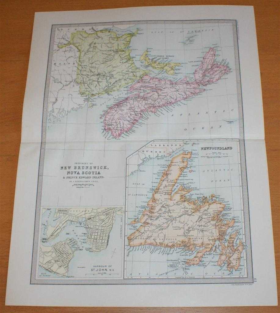
Title: Map of Newfoundland, New Brunswick, Nova Scotia & Prince Edward Island - Sheet 61 disbound from the 1890 'The Library Reference Atlas of the World', 'Canada Lower Provinces' with Plan of St John Harbour
Description: Macmillan and Co. London, 1890. First Edition, Softcover. Very Good Condition/No Dust Jacket. Single disbound coloured map sheet, from John Bartholomew's Library Reference Atlas. Suitable for framing. Approx size 46 x 35cm, horizontal centre fold. Map is clean, crisp and bright, occasional light foxing in margin. Map covers part of Canada, with New Brunswick, Nova Scotia and Prince Edward Island in the top half of the sheet. The bottom half is divided into to panels; Newfoundland and Harbour of St. John. No dust jacket, as published. Quantity Available: 1. Shipped Weight: under 1 kg. Pictures of this item not already displayed here available upon request. Inventory No: 45021014043. ISBN: 0718132130
Keywords: BZDB4 Maps; World History; Geology, geography, mineralogy, environment; USA & Canada. John Bartholomew Map of Newfoundland, New Brunswick, Nova Scotia & Prince Edward Island - Sheet 61 disbound from the 1890 'The Library Reference Atlas of the World', 'Ca
See more books from our catalog: Maps
Title: Map of Newfoundland, New Brunswick, Nova Scotia & Prince Edward Island - Sheet 61 disbound from the 1890 'The Library Reference Atlas of the World', 'Canada Lower Provinces' with Plan of St John Harbour
Description: Macmillan and Co. London, 1890. First Edition, Softcover. Very Good Condition/No Dust Jacket. Single disbound coloured map sheet, from John Bartholomew's Library Reference Atlas. Suitable for framing. Approx size 46 x 35cm, horizontal centre fold. Map is clean, crisp and bright, occasional light foxing in margin. Map covers part of Canada, with New Brunswick, Nova Scotia and Prince Edward Island in the top half of the sheet. The bottom half is divided into to panels; Newfoundland and Harbour of St. John. No dust jacket, as published. Quantity Available: 1. Shipped Weight: under 1 kg. Pictures of this item not already displayed here available upon request. Inventory No: 45021014043. ISBN: 0718132130
Keywords: BZDB4 Maps; World History; Geology, geography, mineralogy, environment; USA & Canada. John Bartholomew Map of Newfoundland, New Brunswick, Nova Scotia & Prince Edward Island - Sheet 61 disbound from the 1890 'The Library Reference Atlas of the World', 'Ca
Price: GBP 34.00 = appr. US$ 48.55 Seller: Bailgate Books Ltd
- Book number: 45021014043
- Book number: 45021014043
See more books from our catalog: Maps