Author: John Bartholomew
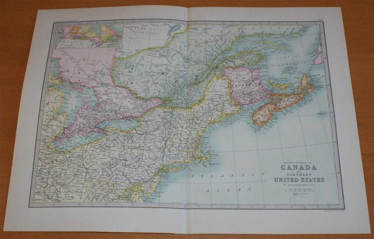
Title: Map of 'Eastern Provinces of Canada and Northern United States' - Sheet 60 disbound from the 1890 'The Library Reference Atlas of the World' with Nova Scotia, New Brunswick, Maine, New York, Pennsylvania, and parts of Quebec and Ontario
Description: Macmillan and Co. London, 1890. First Edition, Softcover. Very Good Condition/No Dust Jacket. Single disbound coloured map sheet, from John Bartholomew's Library Reference Atlas. Suitable for framing. Approx size 35 x 46cm, vertical centre fold. Map is clean, crisp and bright. Map covers part of Canada and the USA, including Nova Scotia, New Brunswick, Prince Edward Island, Cape Breton Island, parts of Quebec and Ontario, New York, Pennsylvania, Maine, Vermont, New Hampshire, New Jersey, Anticost, Gulf of St Lawrence, Lake Huron, Lake Erie and Lake Ontario. No dust jacket, as published. Quantity Available: 1. Shipped Weight: under 1 kg. Pictures of this item not already displayed here available upon request. Inventory No: 45021014042. ISBN: 0718132130
Keywords: BZDB4 Maps; World History; Geology, geography, mineralogy, environment; USA & Canada. John Bartholomew Map of 'Eastern Provinces of Canada and Northern United States' - Sheet 60 disbound from the 1890 'The Library Reference Atlas of the World' with Nova S
See more books from our catalog: Maps
Title: Map of 'Eastern Provinces of Canada and Northern United States' - Sheet 60 disbound from the 1890 'The Library Reference Atlas of the World' with Nova Scotia, New Brunswick, Maine, New York, Pennsylvania, and parts of Quebec and Ontario
Description: Macmillan and Co. London, 1890. First Edition, Softcover. Very Good Condition/No Dust Jacket. Single disbound coloured map sheet, from John Bartholomew's Library Reference Atlas. Suitable for framing. Approx size 35 x 46cm, vertical centre fold. Map is clean, crisp and bright. Map covers part of Canada and the USA, including Nova Scotia, New Brunswick, Prince Edward Island, Cape Breton Island, parts of Quebec and Ontario, New York, Pennsylvania, Maine, Vermont, New Hampshire, New Jersey, Anticost, Gulf of St Lawrence, Lake Huron, Lake Erie and Lake Ontario. No dust jacket, as published. Quantity Available: 1. Shipped Weight: under 1 kg. Pictures of this item not already displayed here available upon request. Inventory No: 45021014042. ISBN: 0718132130
Keywords: BZDB4 Maps; World History; Geology, geography, mineralogy, environment; USA & Canada. John Bartholomew Map of 'Eastern Provinces of Canada and Northern United States' - Sheet 60 disbound from the 1890 'The Library Reference Atlas of the World' with Nova S
Price: GBP 36.00 = appr. US$ 51.41 Seller: Bailgate Books Ltd
- Book number: 45021014042
- Book number: 45021014042
See more books from our catalog: Maps