Author: John Bartholomew
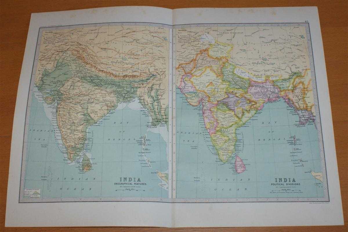
Title: Map of 'India, Physical and Political' - Sheet 45 disbound from the 1890 'The Library Reference Atlas of the World' including Ceylon (Sri Lanka), Nepal, Bhutan and modern day Bangladesh
Description: Macmillan and Co. London, 1890. First Edition, Softcover. Very Good Condition/No Dust Jacket. Single disbound coloured map sheet, from John Bartholomew's Library Reference Atlas. Sheet is divided into to map panels showing the same area, one coloured to show 'Orographical Features' and one showing 'Political Divisions'. Suitable for framing. Approx size 35 x 46cm, vertical centre fold. Some foxing in margins, map is otherwise clean, crisp and bright. Area covered includes India, Sri Lanka (Ceylon), Napal, Bhutan, Andaman Islands, Nicobar Islands, the Maldives, and parts of Tibet, Myanmar (Burma) and Pakistan (Baluchistan). No dust jacket, as published. Quantity Available: 1. Shipped Weight: under 1 kg. Pictures of this item not already displayed here available upon request. Inventory No: 45021014037. ISBN: 0718132130
Keywords: BZDB4 Maps; China, Japan, Nepal & Tibet; World History; Indian sub-continent & South East Asia. John Bartholomew Map of 'India, Physical and Political' - Sheet 45 disbound from the 1890 'The Library Reference Atlas of the World' including Ceylon (Sri Lank
See more books from our catalog: Maps
Title: Map of 'India, Physical and Political' - Sheet 45 disbound from the 1890 'The Library Reference Atlas of the World' including Ceylon (Sri Lanka), Nepal, Bhutan and modern day Bangladesh
Description: Macmillan and Co. London, 1890. First Edition, Softcover. Very Good Condition/No Dust Jacket. Single disbound coloured map sheet, from John Bartholomew's Library Reference Atlas. Sheet is divided into to map panels showing the same area, one coloured to show 'Orographical Features' and one showing 'Political Divisions'. Suitable for framing. Approx size 35 x 46cm, vertical centre fold. Some foxing in margins, map is otherwise clean, crisp and bright. Area covered includes India, Sri Lanka (Ceylon), Napal, Bhutan, Andaman Islands, Nicobar Islands, the Maldives, and parts of Tibet, Myanmar (Burma) and Pakistan (Baluchistan). No dust jacket, as published. Quantity Available: 1. Shipped Weight: under 1 kg. Pictures of this item not already displayed here available upon request. Inventory No: 45021014037. ISBN: 0718132130
Keywords: BZDB4 Maps; China, Japan, Nepal & Tibet; World History; Indian sub-continent & South East Asia. John Bartholomew Map of 'India, Physical and Political' - Sheet 45 disbound from the 1890 'The Library Reference Atlas of the World' including Ceylon (Sri Lank
Price: GBP 33.00 = appr. US$ 47.12 Seller: Bailgate Books Ltd
- Book number: 45021014037
- Book number: 45021014037
See more books from our catalog: Maps