Author: John Bartholomew
Title: Map of the North Atlantic Ocean - Sheet 57 disbound from the 1890 'The Library Reference Atlas of the World' with Shipping Routes and Ocean Currents
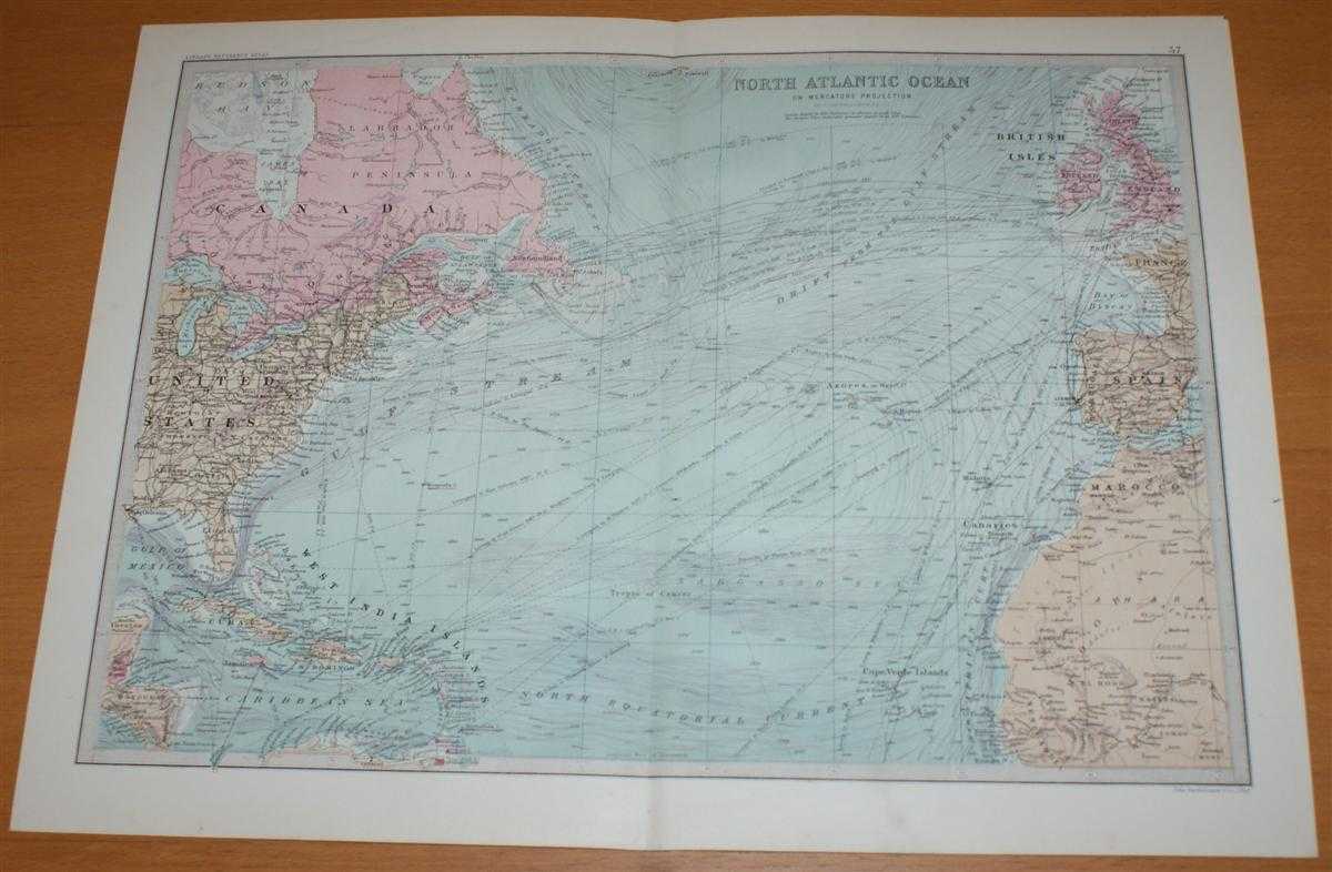
Description: Macmillan and Co. London, 1890. First Edition, Softcover. Very Good Condition/No Dust Jacket. Single disbound coloured map sheet, from John Bartholomew's Library Reference Atlas. Suitable for framing. Approx size 35 x 46cm, vertical centre fold. Map is clean, crisp and bright, margins have slight marks or smudges. Top corners are lightly bumped. Lines and arrows mark currents and shipping routes from Europe to North America and the Caribbean. Map covers the northern half of the Atlantic Ocean, from Cape Farewell (tip of Greenland) to Trinidad, and the surrounding lands. Also includes Madeira, the Canaries, the Azores, Cape Verde Islands, West India Islands, Ireland and Newfoundland, with parts of Canada, USA, Spain, UK and north west Africa. No dust jacket, as published. Quantity Available: 1. Shipped Weight: under 1 kg. Pictures of this item not already displayed here available upon request. Inventory No: 45021014029. ISBN: 0718132130
Keywords: BZDB4 Maps; World History; Geology, geography, mineralogy, environment; naval, naval history, maritime, ships, boats. John Bartholomew Map of the North Atlantic Ocean - Sheet 57 disbound from the 1890 'The Library Reference Atlas of the World' with Shippi
See more books from our catalog: Maps
Title: Map of the North Atlantic Ocean - Sheet 57 disbound from the 1890 'The Library Reference Atlas of the World' with Shipping Routes and Ocean Currents
Description: Macmillan and Co. London, 1890. First Edition, Softcover. Very Good Condition/No Dust Jacket. Single disbound coloured map sheet, from John Bartholomew's Library Reference Atlas. Suitable for framing. Approx size 35 x 46cm, vertical centre fold. Map is clean, crisp and bright, margins have slight marks or smudges. Top corners are lightly bumped. Lines and arrows mark currents and shipping routes from Europe to North America and the Caribbean. Map covers the northern half of the Atlantic Ocean, from Cape Farewell (tip of Greenland) to Trinidad, and the surrounding lands. Also includes Madeira, the Canaries, the Azores, Cape Verde Islands, West India Islands, Ireland and Newfoundland, with parts of Canada, USA, Spain, UK and north west Africa. No dust jacket, as published. Quantity Available: 1. Shipped Weight: under 1 kg. Pictures of this item not already displayed here available upon request. Inventory No: 45021014029. ISBN: 0718132130
Keywords: BZDB4 Maps; World History; Geology, geography, mineralogy, environment; naval, naval history, maritime, ships, boats. John Bartholomew Map of the North Atlantic Ocean - Sheet 57 disbound from the 1890 'The Library Reference Atlas of the World' with Shippi
Price: GBP 34.00 = appr. US$ 48.55 Seller: Bailgate Books Ltd
- Book number: 45021014029
- Book number: 45021014029
See more books from our catalog: Maps