Author: John Bartholomew
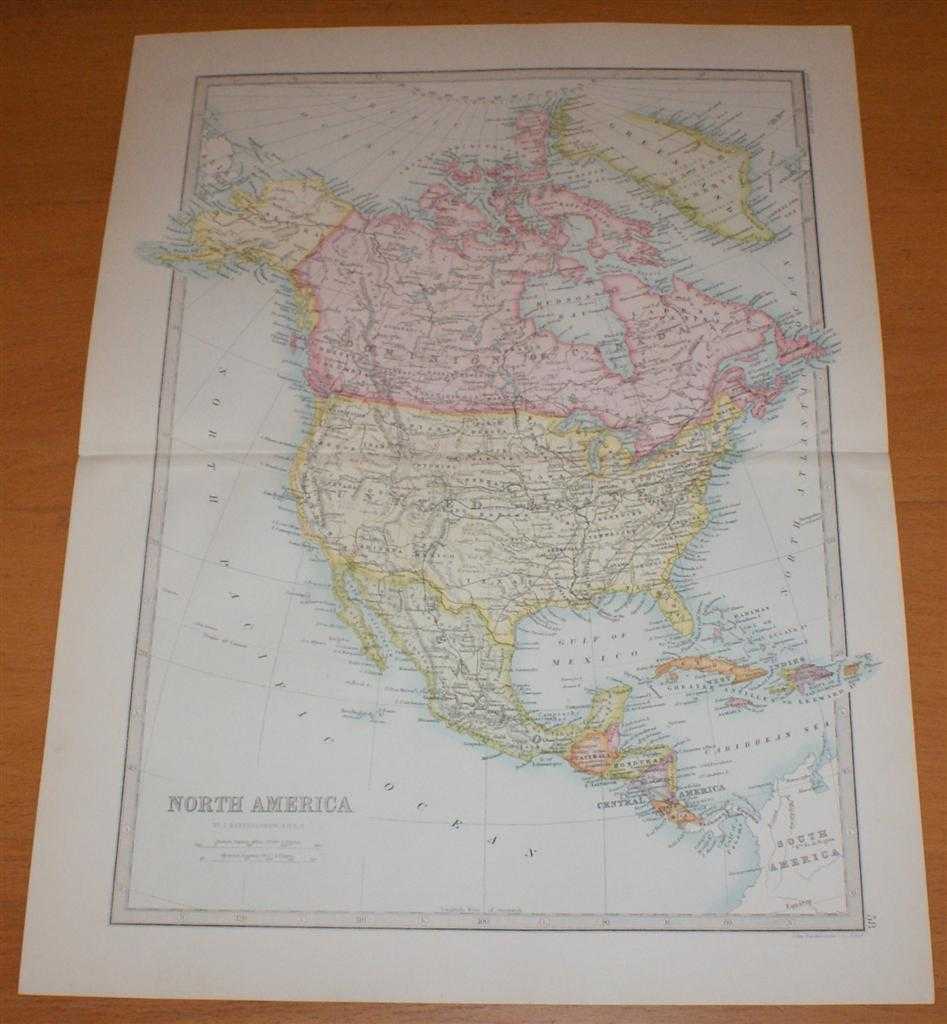
Title: Map of North and Central America - Sheet 58 disbound from the 1890 'The Library Reference Atlas of the World' covering Canada, USA, Mexico, West Indies, Guatemala, Honduras, Nicaragua and Costa Rica
Description: Macmillan and Co. London, 1890. First Edition, Softcover. Very Good Condition/No Dust Jacket. Single disbound coloured map sheet, from John Bartholomew's Library Reference Atlas. Suitable for framing. Approx size 46 x 35cm, horizontal centre fold. Map is clean, crisp and bright. Map includes Canada, the United States of America, Mexico, West Indies, Guatemala, Honduras, Nicaragua, Costa Rica, Panama, parts of Greenland (Danish America) and Colombia, Gulf of Mexico, Caribbean Sea, Hudson Bay, Baffin Bay, Davis Strait, Behring Strait, Arctic Archipelago, etc. No dust jacket, as published. Quantity Available: 1. Shipped Weight: under 1 kg. Pictures of this item not already displayed here available upon request. Inventory No: 45021014028. ISBN: 0718132130
Keywords: BZDB4 Maps; South & Central America & the West Indies; Arctic & Antarctic; USA & Canada. John Bartholomew Map of North and Central America - Sheet 58 disbound from the 1890 'The Library Reference Atlas of the World' covering Canada, USA, Mexico, West Indi
See more books from our catalog: Maps
Title: Map of North and Central America - Sheet 58 disbound from the 1890 'The Library Reference Atlas of the World' covering Canada, USA, Mexico, West Indies, Guatemala, Honduras, Nicaragua and Costa Rica
Description: Macmillan and Co. London, 1890. First Edition, Softcover. Very Good Condition/No Dust Jacket. Single disbound coloured map sheet, from John Bartholomew's Library Reference Atlas. Suitable for framing. Approx size 46 x 35cm, horizontal centre fold. Map is clean, crisp and bright. Map includes Canada, the United States of America, Mexico, West Indies, Guatemala, Honduras, Nicaragua, Costa Rica, Panama, parts of Greenland (Danish America) and Colombia, Gulf of Mexico, Caribbean Sea, Hudson Bay, Baffin Bay, Davis Strait, Behring Strait, Arctic Archipelago, etc. No dust jacket, as published. Quantity Available: 1. Shipped Weight: under 1 kg. Pictures of this item not already displayed here available upon request. Inventory No: 45021014028. ISBN: 0718132130
Keywords: BZDB4 Maps; South & Central America & the West Indies; Arctic & Antarctic; USA & Canada. John Bartholomew Map of North and Central America - Sheet 58 disbound from the 1890 'The Library Reference Atlas of the World' covering Canada, USA, Mexico, West Indi
Price: GBP 38.00 = appr. US$ 54.26 Seller: Bailgate Books Ltd
- Book number: 45021014028
- Book number: 45021014028
See more books from our catalog: Maps