Author: John Bartholomew
Title: Map of the Dominion of Canada - Sheet 59 disbound from the 1890 'The Library Reference Atlas of the World'
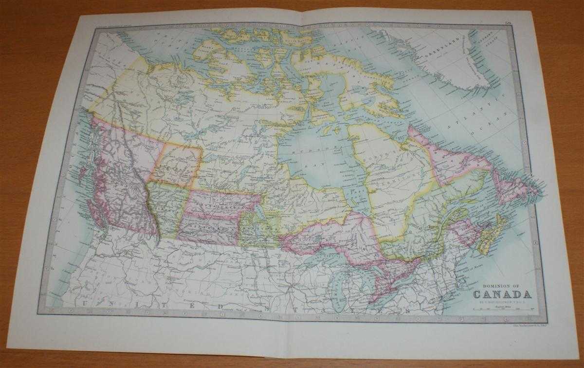
Description: Macmillan and Co. London, 1890. First Edition, Softcover. Very Good Condition/No Dust Jacket. Single disbound coloured map sheet, from John Bartholomew's Library Reference Atlas. Suitable for framing. Approx size 35 x 46cm, vertical centre fold. Map is clean, crisp and bright. Map covers Canada as far north as Bathurst and Melville Islands. The Provinces are coloured in pastel pink, purple, orange and green with the territories and islands to the north in yellow. Surrounding parts of USA and Greenland are mapped but not coloured. No dust jacket, as published. Quantity Available: 1. Shipped Weight: under 1 kg. Pictures of this item not already displayed here available upon request. Inventory No: 45021014027. ISBN: 0718132130
Keywords: BZDB4 Maps; World History; Arctic & Antarctic; USA & Canada. John Bartholomew Map of the Dominion of Canada - Sheet 59 disbound from the 1890 'The Library Reference Atlas of the World' World History Arctic & Antarctic USA & Canada
See more books from our catalog: Maps
Title: Map of the Dominion of Canada - Sheet 59 disbound from the 1890 'The Library Reference Atlas of the World'
Description: Macmillan and Co. London, 1890. First Edition, Softcover. Very Good Condition/No Dust Jacket. Single disbound coloured map sheet, from John Bartholomew's Library Reference Atlas. Suitable for framing. Approx size 35 x 46cm, vertical centre fold. Map is clean, crisp and bright. Map covers Canada as far north as Bathurst and Melville Islands. The Provinces are coloured in pastel pink, purple, orange and green with the territories and islands to the north in yellow. Surrounding parts of USA and Greenland are mapped but not coloured. No dust jacket, as published. Quantity Available: 1. Shipped Weight: under 1 kg. Pictures of this item not already displayed here available upon request. Inventory No: 45021014027. ISBN: 0718132130
Keywords: BZDB4 Maps; World History; Arctic & Antarctic; USA & Canada. John Bartholomew Map of the Dominion of Canada - Sheet 59 disbound from the 1890 'The Library Reference Atlas of the World' World History Arctic & Antarctic USA & Canada
Price: GBP 36.00 = appr. US$ 51.41 Seller: Bailgate Books Ltd
- Book number: 45021014027
- Book number: 45021014027
See more books from our catalog: Maps