Author: John Bartholomew
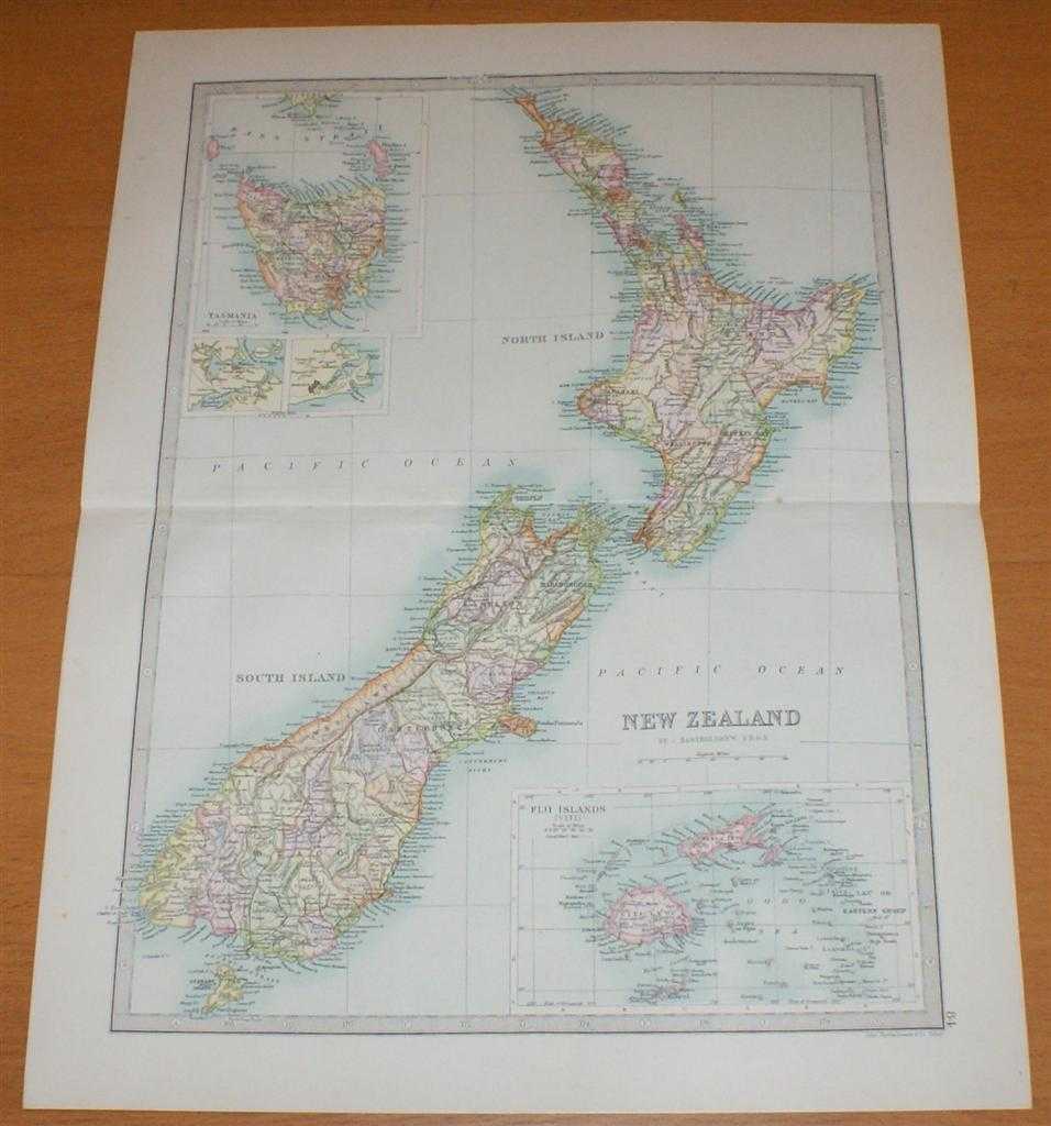
Title: Map of New Zealand, Tasmania and Fiji Islands - Sheet 84 disbound from the 1890 'The Library Reference Atlas of the World'
Description: Macmillan and Co. London, 1890. First Edition, Softcover. Very Good Condition/No Dust Jacket. Single disbound coloured map sheet, from John Bartholomew's Library Reference Atlas. Map shows New Zealand and has inset panels showing Fiji Islands and Tasmania. Suitable for framing. Approx size 46 x 35cm, horizontal centre fold. Occasional light foxing in margin, map is otherwise clean and bright. Slight crinkling at fold, right edge of fold is slightly split in margin. Districts are coloured in pastel shades, main map shows North Island, South Island and Stewart Island. Tasmania and the Fiji Islands (Viti) are shown in inset panels in the top left and bottom right corners of the sheet, also included are two further very small inset panels showing the environs of Auckland and Dunedin. No dust jacket, as published. Quantity Available: 1. Shipped Weight: under 1 kg. Pictures of this item not already displayed here available upon request. Inventory No: 45021014024. ISBN: 0718132130
Keywords: BZDB4 Maps; World History; Geology, geography, mineralogy, environment; Australasia and the Pacific. John Bartholomew Map of New Zealand, Tasmania and Fiji Islands - Sheet 84 disbound from the 1890 'The Library Reference Atlas of the World' World History
See more books from our catalog: Maps
Title: Map of New Zealand, Tasmania and Fiji Islands - Sheet 84 disbound from the 1890 'The Library Reference Atlas of the World'
Description: Macmillan and Co. London, 1890. First Edition, Softcover. Very Good Condition/No Dust Jacket. Single disbound coloured map sheet, from John Bartholomew's Library Reference Atlas. Map shows New Zealand and has inset panels showing Fiji Islands and Tasmania. Suitable for framing. Approx size 46 x 35cm, horizontal centre fold. Occasional light foxing in margin, map is otherwise clean and bright. Slight crinkling at fold, right edge of fold is slightly split in margin. Districts are coloured in pastel shades, main map shows North Island, South Island and Stewart Island. Tasmania and the Fiji Islands (Viti) are shown in inset panels in the top left and bottom right corners of the sheet, also included are two further very small inset panels showing the environs of Auckland and Dunedin. No dust jacket, as published. Quantity Available: 1. Shipped Weight: under 1 kg. Pictures of this item not already displayed here available upon request. Inventory No: 45021014024. ISBN: 0718132130
Keywords: BZDB4 Maps; World History; Geology, geography, mineralogy, environment; Australasia and the Pacific. John Bartholomew Map of New Zealand, Tasmania and Fiji Islands - Sheet 84 disbound from the 1890 'The Library Reference Atlas of the World' World History
Price: GBP 36.00 = appr. US$ 51.41 Seller: Bailgate Books Ltd
- Book number: 45021014024
- Book number: 45021014024
See more books from our catalog: Maps