Author: John Bartholomew
Title: Map of Sweden, Norway, Denmark and the Baltic - Sheet 39 disbound from the 1890 'The Library Reference Atlas of the World'
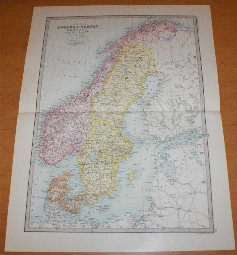
Description: Macmillan and Co. London, 1890. First Edition, Softcover. Very Good Condition/No Dust Jacket. Single disbound coloured map sheet, from John Bartholomew's Library Reference Atlas. Suitable for framing. Approx size 46 x 35cm, horizontal centre fold. Map is clean, crisp and bright, slight split at right edge of fold. Sweden, Norway and Denmark are coloured in pastel shades, surrounding parts of Russia, Finland and Germany are mapped but not coloured. Map includes Baltoc Sea, Gulf of Bothnia, Gulf of Finland, St. Petersburg, Riga, Danzig, Schleswig-Holstein, Hamburg, Gothland, Skager Rack, Lofoden Islands, Varanger Fjord, etc. No dust jacket, as published. Quantity Available: 1. Shipped Weight: under 1 kg. Pictures of this item not already displayed here available upon request. Inventory No: 45021014019. ISBN: 0718132130
Keywords: BZDB4 Maps; European History; Russia & Eastern Europe; Scandinavia. John Bartholomew Map of Sweden, Norway, Denmark and the Baltic - Sheet 39 disbound from the 1890 'The Library Reference Atlas of the World' European History Russia & Eastern Europe Scand
See more books from our catalog: Maps
Title: Map of Sweden, Norway, Denmark and the Baltic - Sheet 39 disbound from the 1890 'The Library Reference Atlas of the World'
Description: Macmillan and Co. London, 1890. First Edition, Softcover. Very Good Condition/No Dust Jacket. Single disbound coloured map sheet, from John Bartholomew's Library Reference Atlas. Suitable for framing. Approx size 46 x 35cm, horizontal centre fold. Map is clean, crisp and bright, slight split at right edge of fold. Sweden, Norway and Denmark are coloured in pastel shades, surrounding parts of Russia, Finland and Germany are mapped but not coloured. Map includes Baltoc Sea, Gulf of Bothnia, Gulf of Finland, St. Petersburg, Riga, Danzig, Schleswig-Holstein, Hamburg, Gothland, Skager Rack, Lofoden Islands, Varanger Fjord, etc. No dust jacket, as published. Quantity Available: 1. Shipped Weight: under 1 kg. Pictures of this item not already displayed here available upon request. Inventory No: 45021014019. ISBN: 0718132130
Keywords: BZDB4 Maps; European History; Russia & Eastern Europe; Scandinavia. John Bartholomew Map of Sweden, Norway, Denmark and the Baltic - Sheet 39 disbound from the 1890 'The Library Reference Atlas of the World' European History Russia & Eastern Europe Scand
Price: GBP 36.00 = appr. US$ 51.41 Seller: Bailgate Books Ltd
- Book number: 45021014019
- Book number: 45021014019
See more books from our catalog: Maps