Author: John Bartholomew
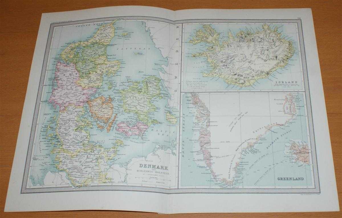
Title: Map of Denmark, Iceland and Greenland - Sheet 38 disbound from the 1890 'The Library Reference Atlas of the World'
Description: Macmillan and Co. London, 1890. First Edition, Softcover. Very Good Condition/No Dust Jacket. Single disbound coloured map sheet, from John Bartholomew's Library Reference Atlas. Suitable for framing. Approx size 35 x 46cm, vertical centre fold. Sheet has occasional light foxing in margins, map is otherwise clean, crisp and bright. Sheet is divided into three panels: Denmark and Scleswig-Holstein; Iceland; Greenland (southern part only - including King Frederick VI coast, King Christian IX Land, Egedes Land, Disko Bay, Liverpool Coast and Scoresby Land). No dust jacket, as published. Quantity Available: 1. Shipped Weight: under 1 kg. Pictures of this item not already displayed here available upon request. Inventory No: 45021014018. ISBN: 0718132130
Keywords: BZDB4 Maps; European History; Germany, Austria, Switzerland and German Language; Scandinavia. John Bartholomew Map of Denmark, Iceland and Greenland - Sheet 38 disbound from the 1890 'The Library Reference Atlas of the World' European History Germany, Aus
See more books from our catalog: Maps
Title: Map of Denmark, Iceland and Greenland - Sheet 38 disbound from the 1890 'The Library Reference Atlas of the World'
Description: Macmillan and Co. London, 1890. First Edition, Softcover. Very Good Condition/No Dust Jacket. Single disbound coloured map sheet, from John Bartholomew's Library Reference Atlas. Suitable for framing. Approx size 35 x 46cm, vertical centre fold. Sheet has occasional light foxing in margins, map is otherwise clean, crisp and bright. Sheet is divided into three panels: Denmark and Scleswig-Holstein; Iceland; Greenland (southern part only - including King Frederick VI coast, King Christian IX Land, Egedes Land, Disko Bay, Liverpool Coast and Scoresby Land). No dust jacket, as published. Quantity Available: 1. Shipped Weight: under 1 kg. Pictures of this item not already displayed here available upon request. Inventory No: 45021014018. ISBN: 0718132130
Keywords: BZDB4 Maps; European History; Germany, Austria, Switzerland and German Language; Scandinavia. John Bartholomew Map of Denmark, Iceland and Greenland - Sheet 38 disbound from the 1890 'The Library Reference Atlas of the World' European History Germany, Aus
Price: GBP 35.00 = appr. US$ 49.98 Seller: Bailgate Books Ltd
- Book number: 45021014018
- Book number: 45021014018
See more books from our catalog: Maps