Author: John Bartholomew
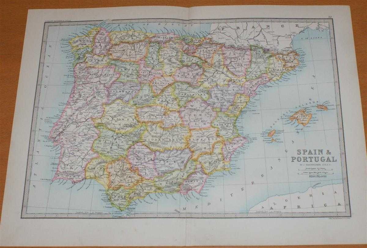
Title: Map of Spain and Portugal (with the Balearic Islands and Andorra) - Sheet 37 disbound from the 1890 'The Library Reference Atlas of the World'
Description: Macmillan and Co. London, 1890. First Edition, Softcover. Very Good Condition/No Dust Jacket. Single disbound coloured map sheet, from John Bartholomew's Library Reference Atlas. Suitable for framing. Approx size 35 x 46cm, vertical centre fold. Sheet has occasional light marks in margins, map is clean, crisp and bright. Fold is a little worn, small split to fold in lower margin, split has been repaired on reverse with archive tape. Provinces are coloured in pastel shades. Map includes Iviza, Majorca and Minorca, the Pyrenees Mountains and neighboring France, Andorra, Algiers and the Strait of Gibraltar. No dust jacket, as published. Quantity Available: 1. Shipped Weight: under 1 kg. Pictures of this item not already displayed here available upon request. Inventory No: 45021014017. ISBN: 0718132130
Keywords: BZDB4 Maps; European History; France and French Language; Spain and Portugal, Spanish & Portuguese Language. John Bartholomew Map of Spain and Portugal (with the Balearic Islands and Andorra) - Sheet 37 disbound from the 1890 'The Library Reference Atlas
See more books from our catalog: Maps
Title: Map of Spain and Portugal (with the Balearic Islands and Andorra) - Sheet 37 disbound from the 1890 'The Library Reference Atlas of the World'
Description: Macmillan and Co. London, 1890. First Edition, Softcover. Very Good Condition/No Dust Jacket. Single disbound coloured map sheet, from John Bartholomew's Library Reference Atlas. Suitable for framing. Approx size 35 x 46cm, vertical centre fold. Sheet has occasional light marks in margins, map is clean, crisp and bright. Fold is a little worn, small split to fold in lower margin, split has been repaired on reverse with archive tape. Provinces are coloured in pastel shades. Map includes Iviza, Majorca and Minorca, the Pyrenees Mountains and neighboring France, Andorra, Algiers and the Strait of Gibraltar. No dust jacket, as published. Quantity Available: 1. Shipped Weight: under 1 kg. Pictures of this item not already displayed here available upon request. Inventory No: 45021014017. ISBN: 0718132130
Keywords: BZDB4 Maps; European History; France and French Language; Spain and Portugal, Spanish & Portuguese Language. John Bartholomew Map of Spain and Portugal (with the Balearic Islands and Andorra) - Sheet 37 disbound from the 1890 'The Library Reference Atlas
Price: GBP 38.00 = appr. US$ 54.26 Seller: Bailgate Books Ltd
- Book number: 45021014017
- Book number: 45021014017
See more books from our catalog: Maps