Author: John Bartholomew
Title: Map of 'German Empire, Holland & Belgium' - Sheet 32 disbound from the 1890 'The Library Reference Atlas of the World'
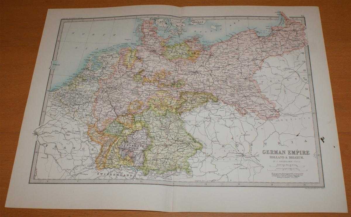
Description: Macmillan and Co. London, 1890. First Edition, Softcover. Good Condition/No Dust Jacket. Single disbound coloured map sheet, from John Bartholomew's Library Reference Atlas. Suitable for framing. Approx size 35 x 46cm, vertical centre fold. Map is crisp, clear and bright. Small ink smudges on right side of sheet, two in margin, one just inside mapped area. Map is otherwise clean. Small tear in bottom margin of sheet, slight creases to top of fold. German States and Prussia are shaded in pastel colours. Map includes modern day Czech Republic (Bohemia) and most of modern day Poland and parts of Austria, France and Switzerland. Cities include Brussels, Antwerp, Rotterdam, Berlin, Hanover, Frankfort, Munster, Munich, Posen, Konigsberg, Vienna, Prague, Warsaw, Cracow, Zurich, Nancy and Paris. No dust jacket, as published. Quantity Available: 1. Shipped Weight: under 1 kg. Pictures of this item not already displayed here available upon request. Inventory No: 45021014013. ISBN: 0718132130
Keywords: BZDB4 Maps; European History; Russia & Eastern Europe; Germany, Austria, Switzerland and German Language. John Bartholomew Map of 'German Empire, Holland & Belgium' - Sheet 32 disbound from the 1890 'The Library Reference Atlas of the World' European Hist
See more books from our catalog: Maps
Title: Map of 'German Empire, Holland & Belgium' - Sheet 32 disbound from the 1890 'The Library Reference Atlas of the World'
Description: Macmillan and Co. London, 1890. First Edition, Softcover. Good Condition/No Dust Jacket. Single disbound coloured map sheet, from John Bartholomew's Library Reference Atlas. Suitable for framing. Approx size 35 x 46cm, vertical centre fold. Map is crisp, clear and bright. Small ink smudges on right side of sheet, two in margin, one just inside mapped area. Map is otherwise clean. Small tear in bottom margin of sheet, slight creases to top of fold. German States and Prussia are shaded in pastel colours. Map includes modern day Czech Republic (Bohemia) and most of modern day Poland and parts of Austria, France and Switzerland. Cities include Brussels, Antwerp, Rotterdam, Berlin, Hanover, Frankfort, Munster, Munich, Posen, Konigsberg, Vienna, Prague, Warsaw, Cracow, Zurich, Nancy and Paris. No dust jacket, as published. Quantity Available: 1. Shipped Weight: under 1 kg. Pictures of this item not already displayed here available upon request. Inventory No: 45021014013. ISBN: 0718132130
Keywords: BZDB4 Maps; European History; Russia & Eastern Europe; Germany, Austria, Switzerland and German Language. John Bartholomew Map of 'German Empire, Holland & Belgium' - Sheet 32 disbound from the 1890 'The Library Reference Atlas of the World' European Hist
Price: GBP 36.00 = appr. US$ 51.41 Seller: Bailgate Books Ltd
- Book number: 45021014013
- Book number: 45021014013
See more books from our catalog: Maps