Author: John Bartholomew
Title: Map of The World showing the Extent and Distribution of the British Empire - Sheet 6 disbound from the 1890 'The Library Reference Atlas of the World'
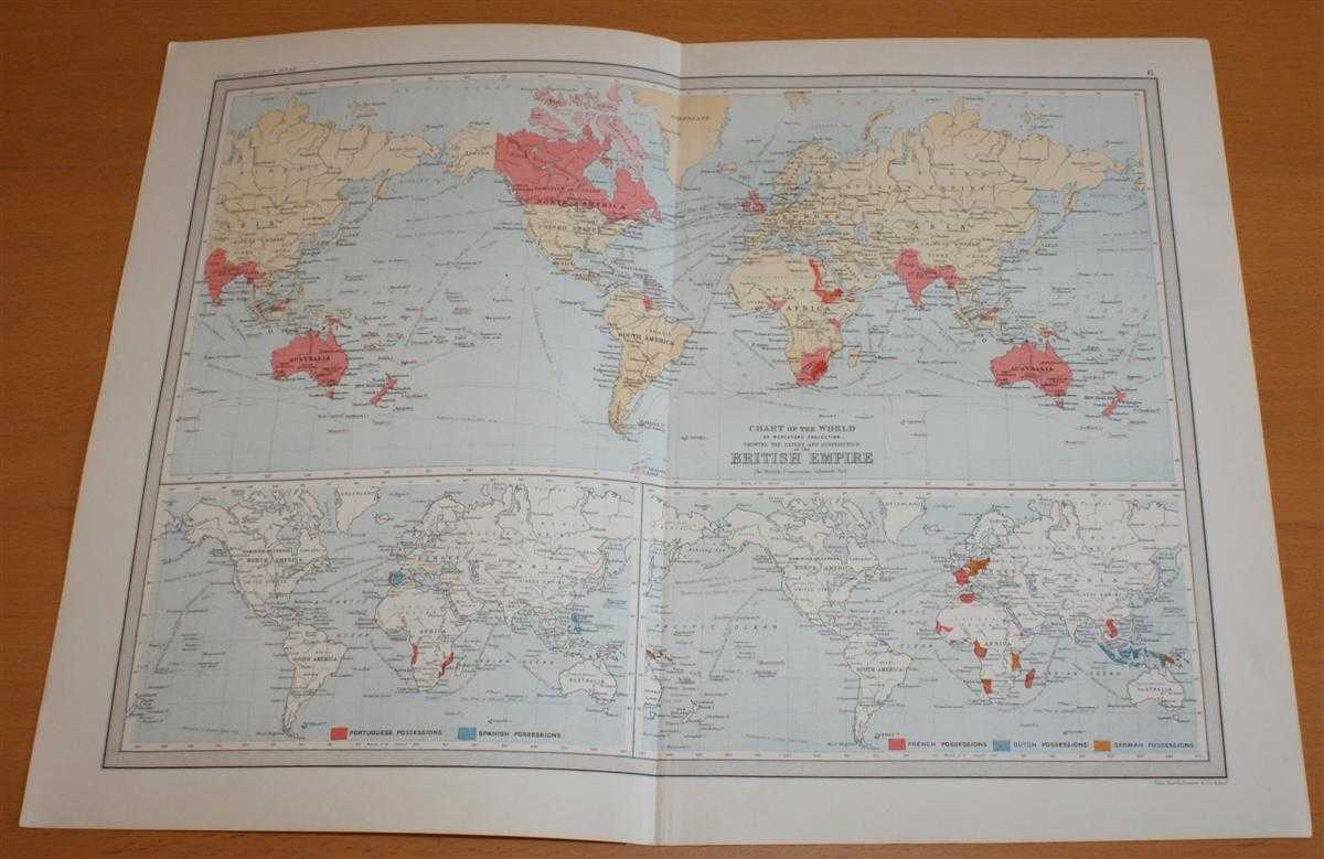
Description: Macmillan and Co. London, 1890. First Edition, Softcover. Good Condition/No Dust Jacket. Single disbound coloured map sheet, from John Bartholomew's Library Reference Atlas. Suitable for framing. Approx size 35 x 46cm, vertical centre fold. Map is clean, crisp, clear and bright. Sheet is split into three panels, each with a map of the world. The largest pannel shows the extent of the British Empire at time of printing (two areas in Africa have been coloured after publication). The two smaller map panels show Portugese, Spanish, French, Dutch and German Possessions. No dust jacket, as published. Quantity Available: 1. Shipped Weight: under 1 kg. Pictures of this item not already displayed here available upon request. Inventory No: 45021014010. ISBN: 0718132130
Keywords: BZDB4 Maps; World History; Geology, geography, mineralogy, environment; British History. John Bartholomew Map of The World showing the Extent and Distribution of the British Empire - Sheet 6 disbound from the 1890 'The Library Reference Atlas of the World
See more books from our catalog: Maps
Title: Map of The World showing the Extent and Distribution of the British Empire - Sheet 6 disbound from the 1890 'The Library Reference Atlas of the World'
Description: Macmillan and Co. London, 1890. First Edition, Softcover. Good Condition/No Dust Jacket. Single disbound coloured map sheet, from John Bartholomew's Library Reference Atlas. Suitable for framing. Approx size 35 x 46cm, vertical centre fold. Map is clean, crisp, clear and bright. Sheet is split into three panels, each with a map of the world. The largest pannel shows the extent of the British Empire at time of printing (two areas in Africa have been coloured after publication). The two smaller map panels show Portugese, Spanish, French, Dutch and German Possessions. No dust jacket, as published. Quantity Available: 1. Shipped Weight: under 1 kg. Pictures of this item not already displayed here available upon request. Inventory No: 45021014010. ISBN: 0718132130
Keywords: BZDB4 Maps; World History; Geology, geography, mineralogy, environment; British History. John Bartholomew Map of The World showing the Extent and Distribution of the British Empire - Sheet 6 disbound from the 1890 'The Library Reference Atlas of the World
Price: GBP 32.00 = appr. US$ 45.70 Seller: Bailgate Books Ltd
- Book number: 45021014010
- Book number: 45021014010
See more books from our catalog: Maps