Author: John Bartholomew
Title: Commercial Map of The World - Sheet 7 disbound from the 1890 'The Library Reference Atlas of the World' with principal rail, steam and sailing routes
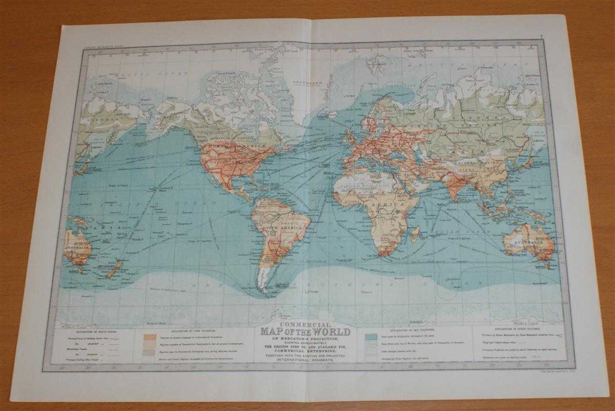
Description: Macmillan and Co. London, 1890. First Edition, Softcover. Very Good Condition/No Dust Jacket. Single disbound coloured map sheet, from John Bartholomew's Library Reference Atlas. Suitable for framing. Approx size 35 x 46cm, vertical centre fold. Map is clean, crisp, clear and bright. Full title of sheet is 'Commercial Map of the World on Mercator's Projection, showing approximately the Regions Open To, and Available For, Commercial Enterprise, together with the Existing and Projected International Highways.' Features include: Through-lines of Railways, Steamship Tracks, Sailing Ship Tracks, Rivers Navigable by River-Steamers and principal products by country. Map is shaded by levels of commercial development. No dust jacket, as published. Quantity Available: 1. Shipped Weight: under 1 kg. Pictures of this item not already displayed here available upon request. Inventory No: 45021014009. ISBN: 0718132130
Keywords: BZDB4 Maps; Geology, geography, mineralogy, environment; naval, naval history, maritime, ships, boats; Management, business, economics, accountancy etc. John Bartholomew Commercial Map of The World - Sheet 7 disbound from the 1890 'The Library Reference A
See more books from our catalog: Maps
Title: Commercial Map of The World - Sheet 7 disbound from the 1890 'The Library Reference Atlas of the World' with principal rail, steam and sailing routes
Description: Macmillan and Co. London, 1890. First Edition, Softcover. Very Good Condition/No Dust Jacket. Single disbound coloured map sheet, from John Bartholomew's Library Reference Atlas. Suitable for framing. Approx size 35 x 46cm, vertical centre fold. Map is clean, crisp, clear and bright. Full title of sheet is 'Commercial Map of the World on Mercator's Projection, showing approximately the Regions Open To, and Available For, Commercial Enterprise, together with the Existing and Projected International Highways.' Features include: Through-lines of Railways, Steamship Tracks, Sailing Ship Tracks, Rivers Navigable by River-Steamers and principal products by country. Map is shaded by levels of commercial development. No dust jacket, as published. Quantity Available: 1. Shipped Weight: under 1 kg. Pictures of this item not already displayed here available upon request. Inventory No: 45021014009. ISBN: 0718132130
Keywords: BZDB4 Maps; Geology, geography, mineralogy, environment; naval, naval history, maritime, ships, boats; Management, business, economics, accountancy etc. John Bartholomew Commercial Map of The World - Sheet 7 disbound from the 1890 'The Library Reference A
Price: GBP 34.00 = appr. US$ 48.55 Seller: Bailgate Books Ltd
- Book number: 45021014009
- Book number: 45021014009
See more books from our catalog: Maps