Author: John Bartholomew
Title: Map of Kansas, Nebraska, Colorado, Dakota, Wyoming, Iowa and Missouri - Sheet 73 (part of USA) Disbound from the 1890 'The Library Reference Atlas of the World'
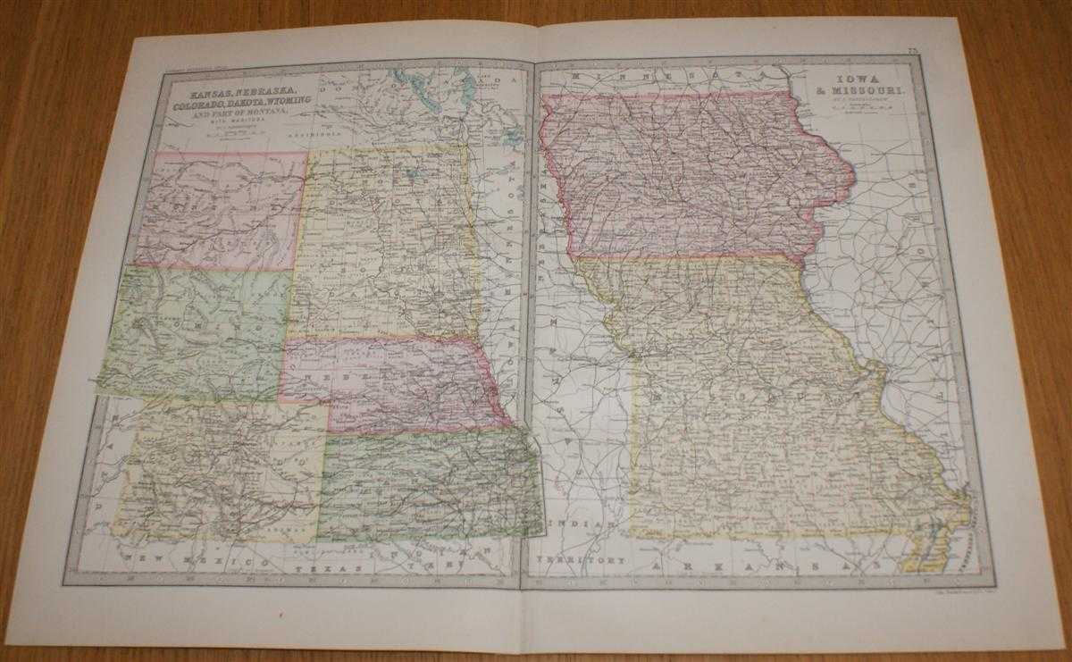
Description: Macmillan and Co. London, 1890. First Edition, Softcover. Very Good Condition/No Dust Jacket. Single disbound coloured map sheet, from John Bartholomew's Library Reference Atlas, covering part of the United States of America. Suitable for framing. Approx size 35 x 46 cm, vertical centre fold. Map is clean, crisp, clear and bright. Sheet contains two map panels side by side; Kansas, Nebraska, Colorado, Dakota, Wyoming and part of Montana, (including Denver, Cheyenne City, Yellowstone, Bismark, Yankton, Lincoln and Topeka). And; Iowa and Missouri (including Omaha City, Dubuque, St. Louis, Siou City and Kansas City). No dust jacket, as published. Quantity Available: 1. Shipped Weight: under 1 kg. Pictures of this item not already displayed here available upon request. Inventory No: 45020124070. ISBN: 0713486848
Keywords: BZDB4 Maps; Geology, geography, mineralogy, environment; World History; USA & Canada. John Bartholomew Map of Kansas, Nebraska, Colorado, Dakota, Wyoming, Iowa and Missouri - Sheet 73 (part of USA) Disbound from the 1890 'The Library Reference Atlas of th
See more books from our catalog: Maps
Title: Map of Kansas, Nebraska, Colorado, Dakota, Wyoming, Iowa and Missouri - Sheet 73 (part of USA) Disbound from the 1890 'The Library Reference Atlas of the World'
Description: Macmillan and Co. London, 1890. First Edition, Softcover. Very Good Condition/No Dust Jacket. Single disbound coloured map sheet, from John Bartholomew's Library Reference Atlas, covering part of the United States of America. Suitable for framing. Approx size 35 x 46 cm, vertical centre fold. Map is clean, crisp, clear and bright. Sheet contains two map panels side by side; Kansas, Nebraska, Colorado, Dakota, Wyoming and part of Montana, (including Denver, Cheyenne City, Yellowstone, Bismark, Yankton, Lincoln and Topeka). And; Iowa and Missouri (including Omaha City, Dubuque, St. Louis, Siou City and Kansas City). No dust jacket, as published. Quantity Available: 1. Shipped Weight: under 1 kg. Pictures of this item not already displayed here available upon request. Inventory No: 45020124070. ISBN: 0713486848
Keywords: BZDB4 Maps; Geology, geography, mineralogy, environment; World History; USA & Canada. John Bartholomew Map of Kansas, Nebraska, Colorado, Dakota, Wyoming, Iowa and Missouri - Sheet 73 (part of USA) Disbound from the 1890 'The Library Reference Atlas of th
Price: GBP 32.00 = appr. US$ 45.70 Seller: Bailgate Books Ltd
- Book number: 45020124070
- Book number: 45020124070
See more books from our catalog: Maps