Author: John Bartholomew
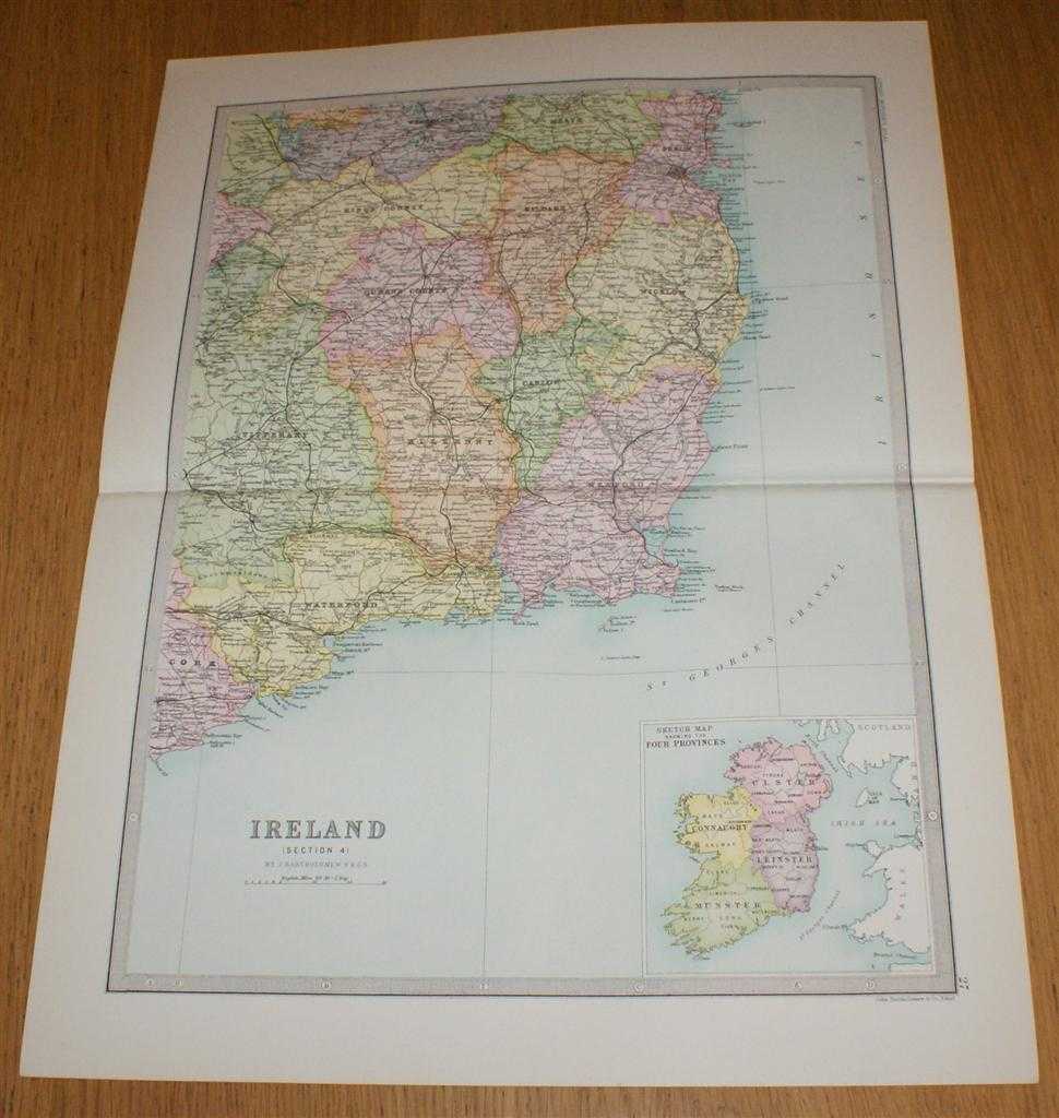
Title: Map of Ireland (Section 4) covering the south eastern portion of Ireland with small inset map showing Four Provinces of Ireland - Sheet 27 Disbound from the 1890 'The Library Reference Atlas of the World'
Description: Macmillan and Co. London, 1890. First Edition, Softcover. Very Good Condition/No Dust Jacket. Single disbound coloured map sheet from John Bartholomew's Library Reference Atlas. Section 4 only of 4 covering Ireland. Approx size 46 x 35 cm, horizontal centre fold. Corners lightly worn. Map is clean, crisp, clear and bright. Sheet covers the south eastern quarter of the island of Ireland including: King's County, Kildare, Dublin, Wicklow, Queen's County, Carlow, Kilkenny, Wexford, Waterford, and parts of Cork, Tipperary, Westmeath and Meath. Sheet contains inset map in lower right corner showing the Four Provinces of Ireland (Connaught, Ulster, Munster and Leinster). No dust jacket, as published. Quantity Available: 1. Shipped Weight: under 1 kg. Pictures of this item not already displayed here available upon request. Inventory No: 45020124014. ISBN: 0297831518
Keywords: BZDB4 Maps; Geology, geography, mineralogy, environment; Ireland. John Bartholomew Map of Ireland (Section 4) covering the south eastern portion of Ireland with small inset map showing Four Provinces of Ireland - Sheet 27 Disbound from the 1890 'The Libra
See more books from our catalog: Maps
Title: Map of Ireland (Section 4) covering the south eastern portion of Ireland with small inset map showing Four Provinces of Ireland - Sheet 27 Disbound from the 1890 'The Library Reference Atlas of the World'
Description: Macmillan and Co. London, 1890. First Edition, Softcover. Very Good Condition/No Dust Jacket. Single disbound coloured map sheet from John Bartholomew's Library Reference Atlas. Section 4 only of 4 covering Ireland. Approx size 46 x 35 cm, horizontal centre fold. Corners lightly worn. Map is clean, crisp, clear and bright. Sheet covers the south eastern quarter of the island of Ireland including: King's County, Kildare, Dublin, Wicklow, Queen's County, Carlow, Kilkenny, Wexford, Waterford, and parts of Cork, Tipperary, Westmeath and Meath. Sheet contains inset map in lower right corner showing the Four Provinces of Ireland (Connaught, Ulster, Munster and Leinster). No dust jacket, as published. Quantity Available: 1. Shipped Weight: under 1 kg. Pictures of this item not already displayed here available upon request. Inventory No: 45020124014. ISBN: 0297831518
Keywords: BZDB4 Maps; Geology, geography, mineralogy, environment; Ireland. John Bartholomew Map of Ireland (Section 4) covering the south eastern portion of Ireland with small inset map showing Four Provinces of Ireland - Sheet 27 Disbound from the 1890 'The Libra
Price: GBP 35.00 = appr. US$ 49.98 Seller: Bailgate Books Ltd
- Book number: 45020124014
- Book number: 45020124014
See more books from our catalog: Maps