Author: John Bartholomew
Title: Map of Ireland (Section 2) covering the North Eastern portion of the island of Ireland including most of Northern Ireland - Sheet 25 Disbound from the 1890 'The Library Reference Atlas of the World'
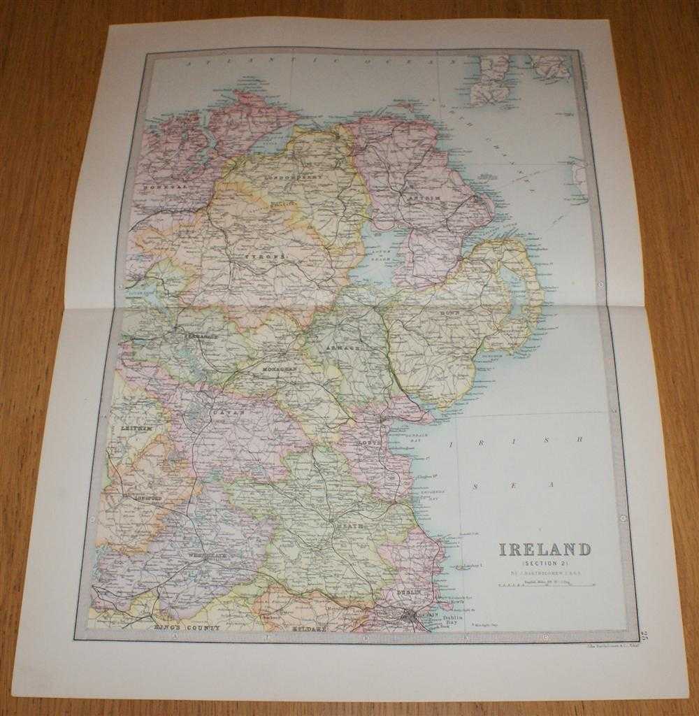
Description: Macmillan and Co. London, 1890. First Edition, Softcover. Very Good Condition/No Dust Jacket. Single disbound coloured map sheet from John Bartholomew's Library Reference Atlas. Section 2 only of 4 covering Ireland. Approx size 46 x 35 cm, horizontal centre fold. Corners lightly worn. Map is clean, crisp, clear and bright. Sheet covers the north eastern quarter of the island of Ireland including: Londonderry, Antrim, Tyrone, Armagh, Down, Monaghan, Louth, Cavan, Meath, Belfast, Dublin, Lough Neath, Lough Foyle, Rathlin Island, Ailsa Craig, and parts of Westmeath, Longford, Leitrim, Fermanagh and Donegal. No dust jacket, as published. Quantity Available: 1. Shipped Weight: under 1 kg. Pictures of this item not already displayed here available upon request. Inventory No: 45020124012. ISBN: 0297831518
Keywords: BZDB4 Maps; Geology, geography, mineralogy, environment; Ireland. John Bartholomew Map of Ireland (Section 2) covering the North Eastern portion of the island of Ireland including most of Northern Ireland - Sheet 25 Disbound from the 1890 'The Library Ref
See more books from our catalog: Maps
Title: Map of Ireland (Section 2) covering the North Eastern portion of the island of Ireland including most of Northern Ireland - Sheet 25 Disbound from the 1890 'The Library Reference Atlas of the World'
Description: Macmillan and Co. London, 1890. First Edition, Softcover. Very Good Condition/No Dust Jacket. Single disbound coloured map sheet from John Bartholomew's Library Reference Atlas. Section 2 only of 4 covering Ireland. Approx size 46 x 35 cm, horizontal centre fold. Corners lightly worn. Map is clean, crisp, clear and bright. Sheet covers the north eastern quarter of the island of Ireland including: Londonderry, Antrim, Tyrone, Armagh, Down, Monaghan, Louth, Cavan, Meath, Belfast, Dublin, Lough Neath, Lough Foyle, Rathlin Island, Ailsa Craig, and parts of Westmeath, Longford, Leitrim, Fermanagh and Donegal. No dust jacket, as published. Quantity Available: 1. Shipped Weight: under 1 kg. Pictures of this item not already displayed here available upon request. Inventory No: 45020124012. ISBN: 0297831518
Keywords: BZDB4 Maps; Geology, geography, mineralogy, environment; Ireland. John Bartholomew Map of Ireland (Section 2) covering the North Eastern portion of the island of Ireland including most of Northern Ireland - Sheet 25 Disbound from the 1890 'The Library Ref
Price: GBP 35.00 = appr. US$ 49.98 Seller: Bailgate Books Ltd
- Book number: 45020124012
- Book number: 45020124012
See more books from our catalog: Maps