Author: John Bartholomew
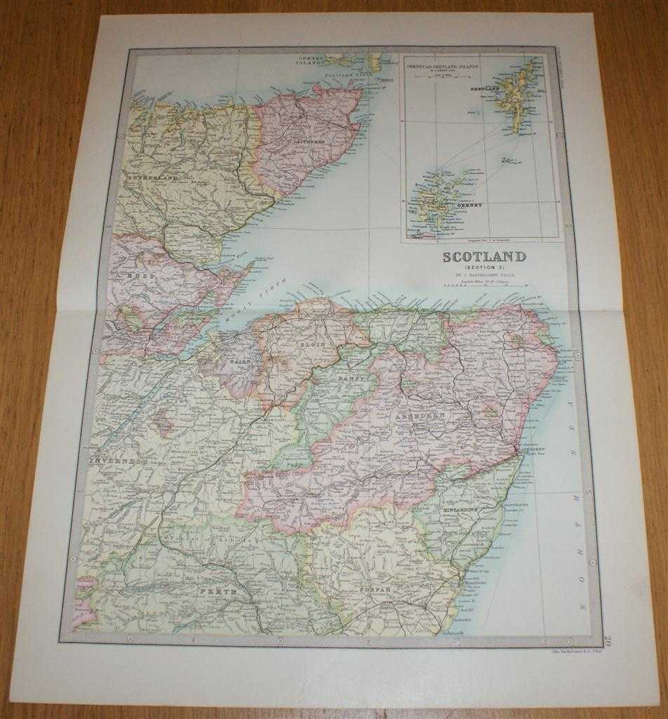
Title: Map of Scotland (Section 2) covering North East Scotland including Thurso, Orkney, Shetland, Inverness, Aberdeen and Montrose - Sheet 20 Disbound from the 1890 'The Library Reference Atlas of the World'
Description: Macmillan and Co. London, 1890. First Edition, Softcover. Very Good Condition/No Dust Jacket. Single disbound coloured map sheet from John Bartholomew's Library Reference Atlas. Section 2 only of 4 covering Scotland. Approx size 46 x 35 cm, horizontal centre fold. Corners lightly worn. Faint smudge in bottom right margin, map is otherwise clean, crisp, clear and bright. Sheet covers North Eastern Scotland with inset continuation panel with Orkney and Shetland Islands, map also includes: Caithness, Nairn, Elgin, Banff, Aberdeen, Kincardine, Loch Ness, Peterhead, Stonehaven, Thurso, Wick, Dornoch Firth, Moray Firth, Montrose, and parts of Sutherland, Ross, Inverness, Perth and Forfar. No dust jacket, as published. Quantity Available: 1. Shipped Weight: under 1 kg. Pictures of this item not already displayed here available upon request. Inventory No: 45020124008. ISBN: 0297831518
Keywords: BZDB4 Maps; naval, naval history, maritime, ships, boats; Geology, geography, mineralogy, environment; Scotland. John Bartholomew Map of Scotland (Section 2) covering North East Scotland including Thurso, Orkney, Shetland, Inverness, Aberdeen and Montrose
See more books from our catalog: Maps
Title: Map of Scotland (Section 2) covering North East Scotland including Thurso, Orkney, Shetland, Inverness, Aberdeen and Montrose - Sheet 20 Disbound from the 1890 'The Library Reference Atlas of the World'
Description: Macmillan and Co. London, 1890. First Edition, Softcover. Very Good Condition/No Dust Jacket. Single disbound coloured map sheet from John Bartholomew's Library Reference Atlas. Section 2 only of 4 covering Scotland. Approx size 46 x 35 cm, horizontal centre fold. Corners lightly worn. Faint smudge in bottom right margin, map is otherwise clean, crisp, clear and bright. Sheet covers North Eastern Scotland with inset continuation panel with Orkney and Shetland Islands, map also includes: Caithness, Nairn, Elgin, Banff, Aberdeen, Kincardine, Loch Ness, Peterhead, Stonehaven, Thurso, Wick, Dornoch Firth, Moray Firth, Montrose, and parts of Sutherland, Ross, Inverness, Perth and Forfar. No dust jacket, as published. Quantity Available: 1. Shipped Weight: under 1 kg. Pictures of this item not already displayed here available upon request. Inventory No: 45020124008. ISBN: 0297831518
Keywords: BZDB4 Maps; naval, naval history, maritime, ships, boats; Geology, geography, mineralogy, environment; Scotland. John Bartholomew Map of Scotland (Section 2) covering North East Scotland including Thurso, Orkney, Shetland, Inverness, Aberdeen and Montrose
Price: GBP 34.00 = appr. US$ 48.55 Seller: Bailgate Books Ltd
- Book number: 45020124008
- Book number: 45020124008
See more books from our catalog: Maps