Author: John Bartholomew
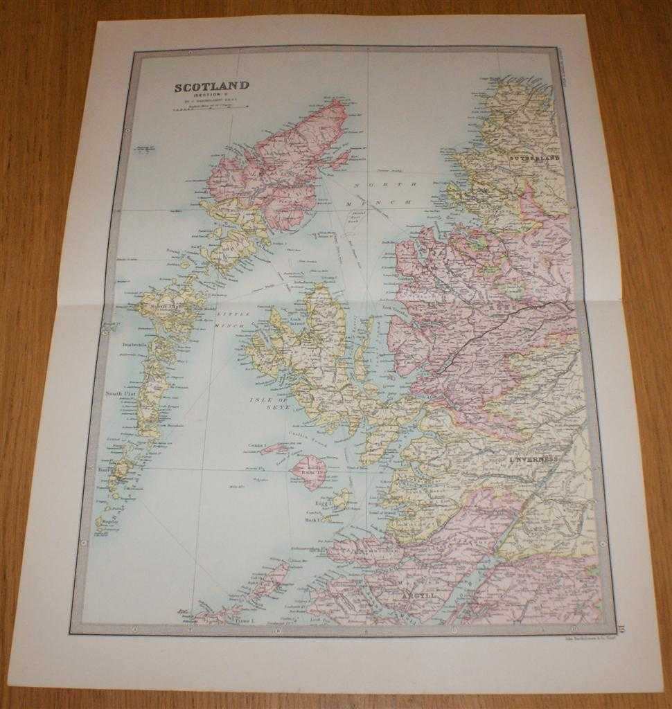
Title: Map of Scotland (Section 1) covering the Western Isles or Outer Hebrides, Skye, Rum and parts of North West Scotland - Sheet 19 Disbound from the 1890 'The Library Reference Atlas of the World'
Description: Macmillan and Co. London, 1890. First Edition, Softcover. Very Good Condition/No Dust Jacket. Single disbound coloured map sheet from John Bartholomew's Library Reference Atlas. Section 1 only of 4 covering Scotland. Approx size 46 x 35 cm, horizontal centre fold. Corners lightly worn. Map is clean, crisp, clear and bright. Sheet covers Outer Hebrides and parts of Inner Hebrides and North West Scotland including: Lewis, Harris, North and South Uist, Barra, Skye, Canna, Rum, Eigg, Coll, Ullapool, Cape Wrath, parts of Sutherland, Ross, Inverness and Argyll, Loch Linnhe, Loch Lochy, Loch Broom, North Minch, etc. No dust jacket, as published. Quantity Available: 1. Shipped Weight: under 1 kg. Pictures of this item not already displayed here available upon request. Inventory No: 45020124007. ISBN: 0297831518
Keywords: BZDB4 Maps; naval, naval history, maritime, ships, boats; Geology, geography, mineralogy, environment; Scotland. John Bartholomew Map of Scotland (Section 1) covering the Western Isles or Outer Hebrides, Skye, Rum and parts of North West Scotland - Sheet
See more books from our catalog: Maps
Title: Map of Scotland (Section 1) covering the Western Isles or Outer Hebrides, Skye, Rum and parts of North West Scotland - Sheet 19 Disbound from the 1890 'The Library Reference Atlas of the World'
Description: Macmillan and Co. London, 1890. First Edition, Softcover. Very Good Condition/No Dust Jacket. Single disbound coloured map sheet from John Bartholomew's Library Reference Atlas. Section 1 only of 4 covering Scotland. Approx size 46 x 35 cm, horizontal centre fold. Corners lightly worn. Map is clean, crisp, clear and bright. Sheet covers Outer Hebrides and parts of Inner Hebrides and North West Scotland including: Lewis, Harris, North and South Uist, Barra, Skye, Canna, Rum, Eigg, Coll, Ullapool, Cape Wrath, parts of Sutherland, Ross, Inverness and Argyll, Loch Linnhe, Loch Lochy, Loch Broom, North Minch, etc. No dust jacket, as published. Quantity Available: 1. Shipped Weight: under 1 kg. Pictures of this item not already displayed here available upon request. Inventory No: 45020124007. ISBN: 0297831518
Keywords: BZDB4 Maps; naval, naval history, maritime, ships, boats; Geology, geography, mineralogy, environment; Scotland. John Bartholomew Map of Scotland (Section 1) covering the Western Isles or Outer Hebrides, Skye, Rum and parts of North West Scotland - Sheet
Price: GBP 35.00 = appr. US$ 49.98 Seller: Bailgate Books Ltd
- Book number: 45020124007
- Book number: 45020124007
See more books from our catalog: Maps