Author: John Bartholomew
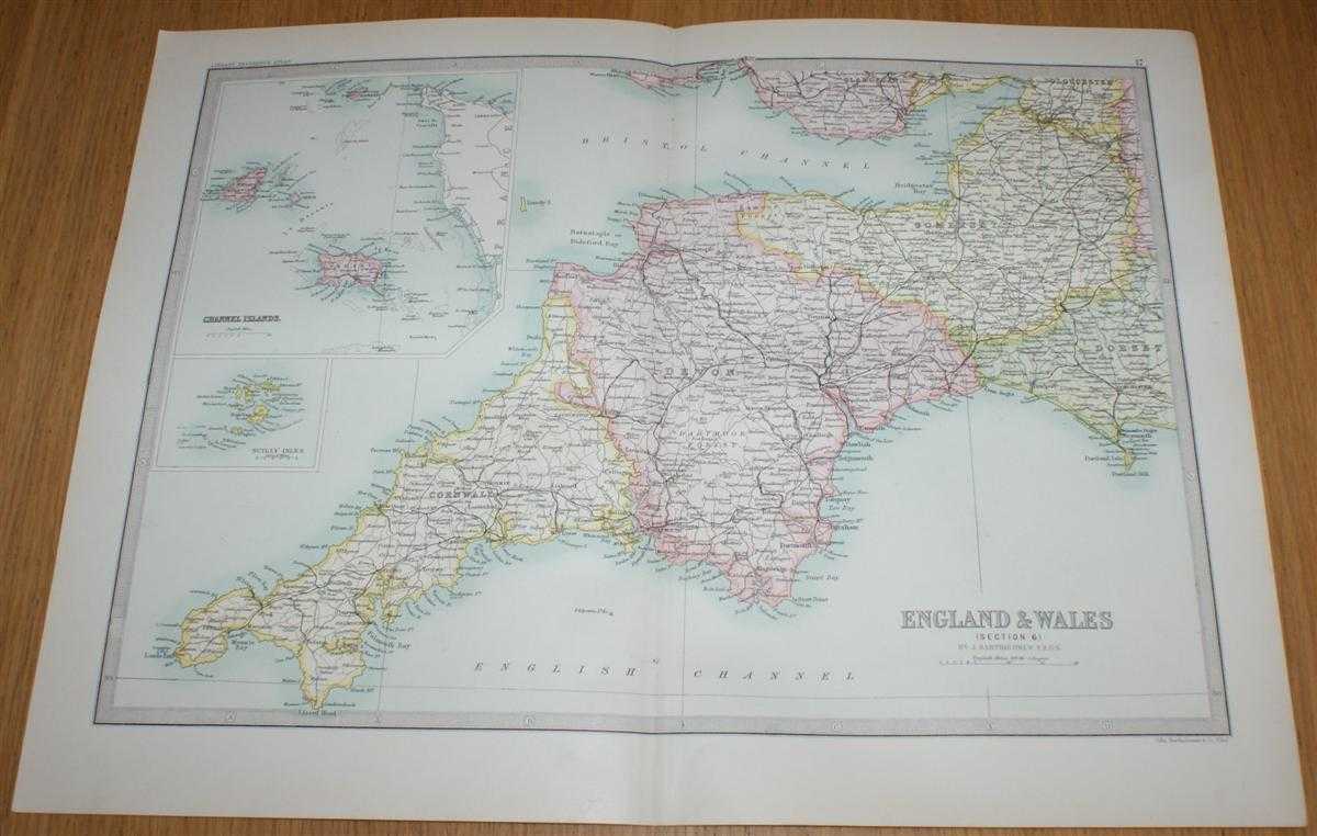
Title: Map of England & Wales (Section 6) covering the West Country (Cornwall, Devon, Somerset) with insets of Scilly Isles and Channel Islands - Sheet 17 Disbound from the 1890 'The Library Reference Atlas of the World'
Description: Macmillan and Co. London, 1890. First Edition, Softcover. Very Good Condition/No Dust Jacket. Single disbound coloured map sheet from John Bartholomew's Library Reference Atlas. Section 6 only of 6 covering England and Wales. Approx size 35 x 46 cm, vertical centre fold. Corners lightly worn. Map is clean, crisp, clear and bright. Sheet covers the West Country including: Cornwall, Devon, Somerset, inset maps of the Scilly Isles and the Channel Islands (Jersey, Guernsey, Alderney, etc.), Bristol, Cardiff, Portland Isle, parts of Dorset, Gloucestershire and Glamorgan. No dust jacket, as published. Quantity Available: 1. Shipped Weight: under 1 kg. Pictures of this item not already displayed here available upon request. Inventory No: 45020124006. ISBN: 0297831518
Keywords: BZDB4 Maps; Channel Islands; British History; West Country - Cornwall, Devon, Somerset & Dorset. John Bartholomew Map of England & Wales (Section 6) covering the West Country (Cornwall, Devon, Somerset) with insets of Scilly Isles and Channel Islands - Sh
See more books from our catalog: Maps
Title: Map of England & Wales (Section 6) covering the West Country (Cornwall, Devon, Somerset) with insets of Scilly Isles and Channel Islands - Sheet 17 Disbound from the 1890 'The Library Reference Atlas of the World'
Description: Macmillan and Co. London, 1890. First Edition, Softcover. Very Good Condition/No Dust Jacket. Single disbound coloured map sheet from John Bartholomew's Library Reference Atlas. Section 6 only of 6 covering England and Wales. Approx size 35 x 46 cm, vertical centre fold. Corners lightly worn. Map is clean, crisp, clear and bright. Sheet covers the West Country including: Cornwall, Devon, Somerset, inset maps of the Scilly Isles and the Channel Islands (Jersey, Guernsey, Alderney, etc.), Bristol, Cardiff, Portland Isle, parts of Dorset, Gloucestershire and Glamorgan. No dust jacket, as published. Quantity Available: 1. Shipped Weight: under 1 kg. Pictures of this item not already displayed here available upon request. Inventory No: 45020124006. ISBN: 0297831518
Keywords: BZDB4 Maps; Channel Islands; British History; West Country - Cornwall, Devon, Somerset & Dorset. John Bartholomew Map of England & Wales (Section 6) covering the West Country (Cornwall, Devon, Somerset) with insets of Scilly Isles and Channel Islands - Sh
Price: GBP 35.00 = appr. US$ 49.98 Seller: Bailgate Books Ltd
- Book number: 45020124006
- Book number: 45020124006
See more books from our catalog: Maps