Author: John Bartholomew
Title: Map of England & Wales (Section 3) covering London, Kent, Essex, Suffolk, Norfolk, Cambridge, Huntingdon, Bedford, etc. - Sheet 14 Disbound from the 1890 'The Library Reference Atlas of the World'
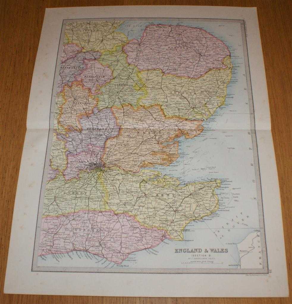
Description: Macmillan and Co. London, 1890. First Edition, Softcover. Very Good Condition/No Dust Jacket. Single disbound coloured map sheet from John Bartholomew's Library Reference Atlas. Section 3 only of 6 covering England and Wales. Approx size 35 x 46 cm, vertical centre fold. Light foxing to margin, corners lightly worn. Map is crisp, clear and bright. Sheet covers parts of the Midlands and the south east of England including: London, Middlesex, Kent, Essex, Suffolk, Norfolk, Cambridge, Huntingdon, Bedford, and parts of Sussex, Surrey, Northampton, Rutland and Lincolnshire, The Wash, Thames Estuary, Strait of Dover, Boulogne and Calais, etc. No dust jacket, as published. Quantity Available: 1. Shipped Weight: under 1 kg. Pictures of this item not already displayed here available upon request. Inventory No: 45020124003. ISBN: 0297831518
Keywords: BZDB4 Maps; East Anglia, fenlands, Cambridgeshire, Norfolk, Suffolk; Bedfordshire, Buckinghamshire, Hertfordshire, Northamptonshire; London & the South East. John Bartholomew Map of England & Wales (Section 3) covering London, Kent, Essex, Suffolk, Norfol
See more books from our catalog: Maps
Title: Map of England & Wales (Section 3) covering London, Kent, Essex, Suffolk, Norfolk, Cambridge, Huntingdon, Bedford, etc. - Sheet 14 Disbound from the 1890 'The Library Reference Atlas of the World'
Description: Macmillan and Co. London, 1890. First Edition, Softcover. Very Good Condition/No Dust Jacket. Single disbound coloured map sheet from John Bartholomew's Library Reference Atlas. Section 3 only of 6 covering England and Wales. Approx size 35 x 46 cm, vertical centre fold. Light foxing to margin, corners lightly worn. Map is crisp, clear and bright. Sheet covers parts of the Midlands and the south east of England including: London, Middlesex, Kent, Essex, Suffolk, Norfolk, Cambridge, Huntingdon, Bedford, and parts of Sussex, Surrey, Northampton, Rutland and Lincolnshire, The Wash, Thames Estuary, Strait of Dover, Boulogne and Calais, etc. No dust jacket, as published. Quantity Available: 1. Shipped Weight: under 1 kg. Pictures of this item not already displayed here available upon request. Inventory No: 45020124003. ISBN: 0297831518
Keywords: BZDB4 Maps; East Anglia, fenlands, Cambridgeshire, Norfolk, Suffolk; Bedfordshire, Buckinghamshire, Hertfordshire, Northamptonshire; London & the South East. John Bartholomew Map of England & Wales (Section 3) covering London, Kent, Essex, Suffolk, Norfol
Price: GBP 32.00 = appr. US$ 45.70 Seller: Bailgate Books Ltd
- Book number: 45020124003
- Book number: 45020124003
See more books from our catalog: Maps