Author: John Bartholomew
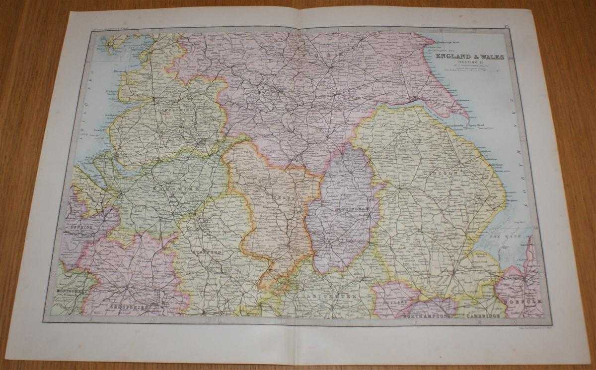
Title: Map of England & Wales (Section 2) covering Cheshire, Lincolnshire, Derbyshire, Nottinghamshire, East and West Ridings of Yorkshire, etc. - Sheet 13 Disbound from the 1890 'The Library Reference Atlas of the World'
Description: Macmillan and Co. London, 1890. First Edition, Softcover. Very Good Condition/No Dust Jacket. Single disbound coloured map sheet from John Bartholomew's Library Reference Atlas. Section 2 only of 6 covering England and Wales. Approx size 35 x 46 cm, vertical centre fold. Slight smudges and foxing to margin, corners lightly worn. Map is crisp, clear and bright. Sheet covers parts of the Midlands and northern England including: Cheshire, Lincolnshire, Derbyshire, Nottinghamshire, East and West Ridings of Yorkshire, York, Leeds, Hull, Rivers Mersey, Dee and Humber, The Wash, and parts of Lancashire, Shropshire, Staffordshire, Leicestershire, Rutland, etc. No dust jacket, as published. Quantity Available: 1. Shipped Weight: under 1 kg. Pictures of this item not already displayed here available upon request. Inventory No: 45020124002. ISBN: 0297831518
Keywords: BZDB4 Maps; Yorkshire; Lincoln & Lincolnshire; Nottingham & Nottinghamshire. John Bartholomew Map of England & Wales (Section 2) covering Cheshire, Lincolnshire, Derbyshire, Nottinghamshire, East and West Ridings of Yorkshire, etc. - Sheet 13 Disbound fro
See more books from our catalog: Maps
Title: Map of England & Wales (Section 2) covering Cheshire, Lincolnshire, Derbyshire, Nottinghamshire, East and West Ridings of Yorkshire, etc. - Sheet 13 Disbound from the 1890 'The Library Reference Atlas of the World'
Description: Macmillan and Co. London, 1890. First Edition, Softcover. Very Good Condition/No Dust Jacket. Single disbound coloured map sheet from John Bartholomew's Library Reference Atlas. Section 2 only of 6 covering England and Wales. Approx size 35 x 46 cm, vertical centre fold. Slight smudges and foxing to margin, corners lightly worn. Map is crisp, clear and bright. Sheet covers parts of the Midlands and northern England including: Cheshire, Lincolnshire, Derbyshire, Nottinghamshire, East and West Ridings of Yorkshire, York, Leeds, Hull, Rivers Mersey, Dee and Humber, The Wash, and parts of Lancashire, Shropshire, Staffordshire, Leicestershire, Rutland, etc. No dust jacket, as published. Quantity Available: 1. Shipped Weight: under 1 kg. Pictures of this item not already displayed here available upon request. Inventory No: 45020124002. ISBN: 0297831518
Keywords: BZDB4 Maps; Yorkshire; Lincoln & Lincolnshire; Nottingham & Nottinghamshire. John Bartholomew Map of England & Wales (Section 2) covering Cheshire, Lincolnshire, Derbyshire, Nottinghamshire, East and West Ridings of Yorkshire, etc. - Sheet 13 Disbound fro
Price: GBP 32.00 = appr. US$ 45.70 Seller: Bailgate Books Ltd
- Book number: 45020124002
- Book number: 45020124002
See more books from our catalog: Maps