Author: John Bartholomew
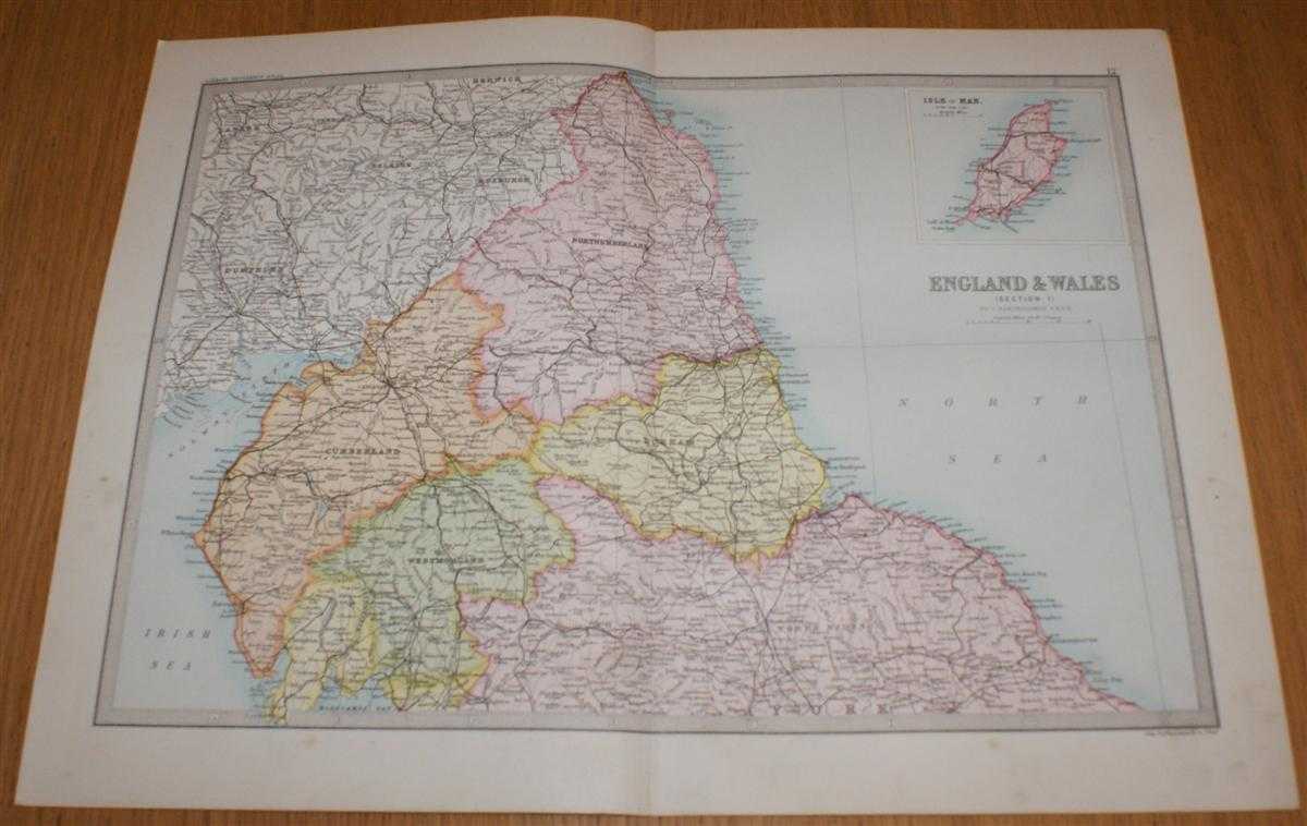
Title: Map of England & Wales (Section 1) covering Northumberland, Durham, Cumberland, Westmorland, Scottish Border, etc. with inset of Isle of Man - Sheet 12 Disbound from the 1890 'The Library Reference Atlas of the World'
Description: Macmillan and Co. London, 1890. First Edition, Softcover. Very Good Condition/No Dust Jacket. Single disbound coloured map sheet from John Bartholomew's Library Reference Atlas. Section 1 only of 6 covering England and Wales. Approx size 35 x 46 cm, vertical centre fold. Slight smudges and foxing to margin, corners lightly worn. Map is crisp, clear and bright. Sheet covers northern parts of England including: Northumberland, Durham, Cumberland, Westmorland, North Riding of Yorkshire, Scottish Border, Isle of Man (inset panel in top right of sheet), Roxburgh, Selkirk, Peebles, Dumfries, Solway Firth, Carlisle, Newcastle, and Scarborough. No dust jacket, as published. Quantity Available: 1. Shipped Weight: under 1 kg. Pictures of this item not already displayed here available upon request. Inventory No: 45020124001. ISBN: 0297831518
Keywords: BZDB4 Maps; Durham, Northumberland and North east England ; Cumbria, Cumberland, Westmorland, Lake District; Isle of Man. John Bartholomew Map of England & Wales (Section 1) covering Northumberland, Durham, Cumberland, Westmorland, Scottish Border, etc. w
See more books from our catalog: Maps
Title: Map of England & Wales (Section 1) covering Northumberland, Durham, Cumberland, Westmorland, Scottish Border, etc. with inset of Isle of Man - Sheet 12 Disbound from the 1890 'The Library Reference Atlas of the World'
Description: Macmillan and Co. London, 1890. First Edition, Softcover. Very Good Condition/No Dust Jacket. Single disbound coloured map sheet from John Bartholomew's Library Reference Atlas. Section 1 only of 6 covering England and Wales. Approx size 35 x 46 cm, vertical centre fold. Slight smudges and foxing to margin, corners lightly worn. Map is crisp, clear and bright. Sheet covers northern parts of England including: Northumberland, Durham, Cumberland, Westmorland, North Riding of Yorkshire, Scottish Border, Isle of Man (inset panel in top right of sheet), Roxburgh, Selkirk, Peebles, Dumfries, Solway Firth, Carlisle, Newcastle, and Scarborough. No dust jacket, as published. Quantity Available: 1. Shipped Weight: under 1 kg. Pictures of this item not already displayed here available upon request. Inventory No: 45020124001. ISBN: 0297831518
Keywords: BZDB4 Maps; Durham, Northumberland and North east England ; Cumbria, Cumberland, Westmorland, Lake District; Isle of Man. John Bartholomew Map of England & Wales (Section 1) covering Northumberland, Durham, Cumberland, Westmorland, Scottish Border, etc. w
Price: GBP 32.00 = appr. US$ 45.70 Seller: Bailgate Books Ltd
- Book number: 45020124001
- Book number: 45020124001
See more books from our catalog: Maps