Author: The Times and J. G. Bartholomew
Title: World Maps showing Population, Races, Religions and Principal Languages of Commerce from the 1920 Times Atlas (Plate 5) - single sheet containing 4 maps
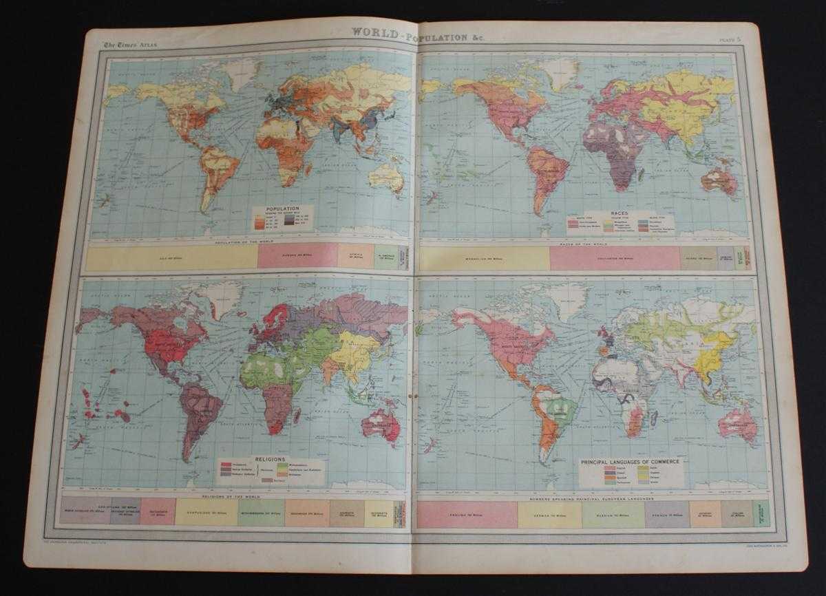
Description: The Times, London, 1920. First Edition, Softcover. Very Good Condition/No Dust Jacket. Disbound single sheet with vertical centre fold from the 1920 "The Times Survey Atlas of the World". Sheet is subdivided into four maps. Maps are in colour and sheet is suitable for framing. All maps have related bar charts underneath with contemporary statistical information. The four maps are coloured by: Population per square mile; Race of the World (with subdivisions of "White Type, Yellow Type and Black Type"); Religions across the World; Principal Languages of Commerce (bar chart shows data for European Languages only). Sheet has slightly darkened and worn edges with occasional light foxing. Sheet is otherwise clean and bright. Size: 46cm x 58cm approx. Quantity Available: 1. Shipped Weight: under 1 kg. Pictures of this item not already displayed here available upon request. Inventory No: 45020044034. ISBN: 0586044434
Keywords: BZDB4 Maps; Religion and Theology; World History; Geology, geography, mineralogy, environment. The Times and J. G. Bartholomew World Maps showing Population, Races, Religions and Principal Languages of Commerce from the 1920 Times Atlas (Plate 5) - single
See more books from our catalog: Maps
Title: World Maps showing Population, Races, Religions and Principal Languages of Commerce from the 1920 Times Atlas (Plate 5) - single sheet containing 4 maps
Description: The Times, London, 1920. First Edition, Softcover. Very Good Condition/No Dust Jacket. Disbound single sheet with vertical centre fold from the 1920 "The Times Survey Atlas of the World". Sheet is subdivided into four maps. Maps are in colour and sheet is suitable for framing. All maps have related bar charts underneath with contemporary statistical information. The four maps are coloured by: Population per square mile; Race of the World (with subdivisions of "White Type, Yellow Type and Black Type"); Religions across the World; Principal Languages of Commerce (bar chart shows data for European Languages only). Sheet has slightly darkened and worn edges with occasional light foxing. Sheet is otherwise clean and bright. Size: 46cm x 58cm approx. Quantity Available: 1. Shipped Weight: under 1 kg. Pictures of this item not already displayed here available upon request. Inventory No: 45020044034. ISBN: 0586044434
Keywords: BZDB4 Maps; Religion and Theology; World History; Geology, geography, mineralogy, environment. The Times and J. G. Bartholomew World Maps showing Population, Races, Religions and Principal Languages of Commerce from the 1920 Times Atlas (Plate 5) - single
Price: GBP 22.00 = appr. US$ 31.42 Seller: Bailgate Books Ltd
- Book number: 45020044034
- Book number: 45020044034
See more books from our catalog: Maps