Author: The Times and J. G. Bartholomew
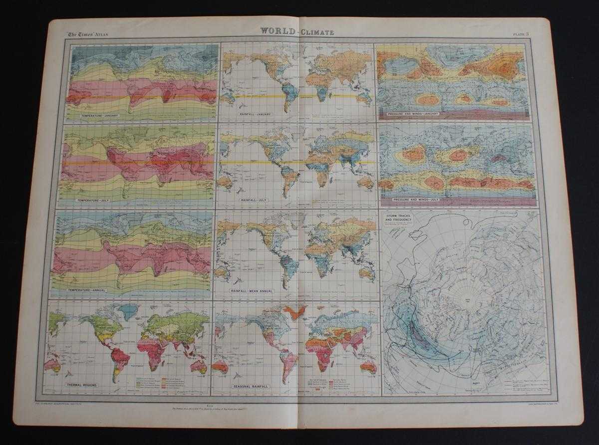
Title: World Climate Maps from the 1920 Times Atlas (Plate 3) - single sheet containing 11 small maps depicting World Temperature levels, Rainfall and Pressure and Winds
Description: The Times, London, 1920. First Edition, Softcover. Very Good Condition/No Dust Jacket. Disbound single sheet with vertical centre fold from the 1920 "The Times Survey Atlas of the World". Maps are in colour and sheet is suitable for framing. Sheet is divided into 11 panels which show information on: World Temperatures (January, July, Annual); Thermal Regions; World Rainfall (January, July, Mean Annual, Seasonal); Pressure and Winds (January, July); Storm Tracks and Frequency (centring on the North Pole). Slightly darkened and worn edges with occasional light foxing and slight creases in the margins. Sheet is otherwise clean and bright. Size: 46cm x 58cm approx. Quantity Available: 1. Shipped Weight: under 1 kg. Pictures of this item not already displayed here available upon request. Inventory No: 45020044032. ISBN: 0586044434
Keywords: BZDB4 Maps; Science; World History; Geology, geography, mineralogy, environment. The Times and J. G. Bartholomew World Climate Maps from the 1920 Times Atlas (Plate 3) - single sheet containing 11 small maps depicting World Temperature levels, Rainfall an
See more books from our catalog: Maps
Title: World Climate Maps from the 1920 Times Atlas (Plate 3) - single sheet containing 11 small maps depicting World Temperature levels, Rainfall and Pressure and Winds
Description: The Times, London, 1920. First Edition, Softcover. Very Good Condition/No Dust Jacket. Disbound single sheet with vertical centre fold from the 1920 "The Times Survey Atlas of the World". Maps are in colour and sheet is suitable for framing. Sheet is divided into 11 panels which show information on: World Temperatures (January, July, Annual); Thermal Regions; World Rainfall (January, July, Mean Annual, Seasonal); Pressure and Winds (January, July); Storm Tracks and Frequency (centring on the North Pole). Slightly darkened and worn edges with occasional light foxing and slight creases in the margins. Sheet is otherwise clean and bright. Size: 46cm x 58cm approx. Quantity Available: 1. Shipped Weight: under 1 kg. Pictures of this item not already displayed here available upon request. Inventory No: 45020044032. ISBN: 0586044434
Keywords: BZDB4 Maps; Science; World History; Geology, geography, mineralogy, environment. The Times and J. G. Bartholomew World Climate Maps from the 1920 Times Atlas (Plate 3) - single sheet containing 11 small maps depicting World Temperature levels, Rainfall an
Price: GBP 22.00 = appr. US$ 31.42 Seller: Bailgate Books Ltd
- Book number: 45020044032
- Book number: 45020044032
See more books from our catalog: Maps