Author: The Times and J. G. Bartholomew
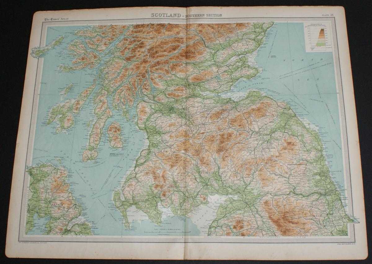
Title: Map of "Scotland - Southern Section" from the 1920 Times Atlas (Plate 21) covering Solway Firth to Montrose including Glasgow, Endinburgh, Arran, Mull, Carlisle, Durham and Belfast
Description: The Times, London, 1920. First Edition, Softcover. Very Good Condition/No Dust Jacket. Disbound single sheet with vertical centre fold from the 1920 "The Times Survey Atlas of the World". Map is in colour and is suitable for framing. Colour on both land and sea according to contour. Map at scale 1:633,600. Map covers southern Scotland, Firth of Clyde, Solway Firth, Firth of Forth, Northumberland, Durham, Cumberland and Antrim (Northern Ireland) and includes Rathlin Island, Belfast, Carlisle, Durham, Newcastle, Berwick, Dumfries, Ayr, Glasgow, Edinburgh, Stirling, Montrose, Argyll, Null, Arran, Jura, Islay, etc. Slightly darkened and worn edges with some light foxing in the margins. Top edge is a little more bumped and darkened than the rest, sheet is otherwise clean and bright. Size: 46cm x 58cm approx. Quantity Available: 1. Shipped Weight: under 1 kg. Pictures of this item not already displayed here available upon request. Inventory No: 45020044027. ISBN: 0586044434
Keywords: BZDB4 Maps; Ireland; Durham, Northumberland and North east England ; Scotland. The Times and J. G. Bartholomew Map of "Scotland - Southern Section" from the 1920 Times Atlas (Plate 21) covering Solway Firth to Montrose including Glasgow, Endinburgh, Arran
See more books from our catalog: Maps
Title: Map of "Scotland - Southern Section" from the 1920 Times Atlas (Plate 21) covering Solway Firth to Montrose including Glasgow, Endinburgh, Arran, Mull, Carlisle, Durham and Belfast
Description: The Times, London, 1920. First Edition, Softcover. Very Good Condition/No Dust Jacket. Disbound single sheet with vertical centre fold from the 1920 "The Times Survey Atlas of the World". Map is in colour and is suitable for framing. Colour on both land and sea according to contour. Map at scale 1:633,600. Map covers southern Scotland, Firth of Clyde, Solway Firth, Firth of Forth, Northumberland, Durham, Cumberland and Antrim (Northern Ireland) and includes Rathlin Island, Belfast, Carlisle, Durham, Newcastle, Berwick, Dumfries, Ayr, Glasgow, Edinburgh, Stirling, Montrose, Argyll, Null, Arran, Jura, Islay, etc. Slightly darkened and worn edges with some light foxing in the margins. Top edge is a little more bumped and darkened than the rest, sheet is otherwise clean and bright. Size: 46cm x 58cm approx. Quantity Available: 1. Shipped Weight: under 1 kg. Pictures of this item not already displayed here available upon request. Inventory No: 45020044027. ISBN: 0586044434
Keywords: BZDB4 Maps; Ireland; Durham, Northumberland and North east England ; Scotland. The Times and J. G. Bartholomew Map of "Scotland - Southern Section" from the 1920 Times Atlas (Plate 21) covering Solway Firth to Montrose including Glasgow, Endinburgh, Arran
Price: GBP 22.00 = appr. US$ 31.42 Seller: Bailgate Books Ltd
- Book number: 45020044027
- Book number: 45020044027
See more books from our catalog: Maps