Author: The Times and J. G. Bartholomew
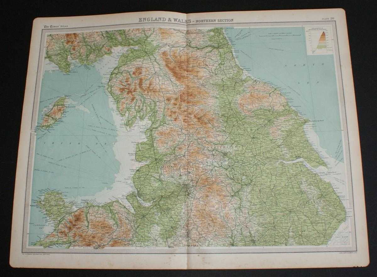
Title: Map of "England and Wales - Northern Section" from the 1920 Times Atlas (Plate 20) covering Yorkshire, Cumbria, Anglesey, Durham, Cheshire, Lancashire, Denbigh and parts of Lincolnshire, Nottinghamshire and Derbyshire
Description: The Times, London, 1920. First Edition, Softcover. Very Good Condition/No Dust Jacket. Disbound single sheet with vertical centre fold from the 1920 "The Times Survey Atlas of the World". Map is in colour and is suitable for framing. Colour on both land and sea according to contour. Map at scale 1:633,600. Map covers Yorkshire, East, West and North Ridings, York, Leeds, Sheffield, Hull, Durham, Newcastle, Blyth, Cumberland, Carlisle, Westmorland, Isle of Man, Douglas, Anglesey, Carnarvon, Denbigh, Flint, Lancashire, Liverpool, Manchester, Cheshire, parts of Lincolnshire, Nottinghamshire and Derbyshire including Lincoln, Sleaford, Nottingham, Derby and Boston. Slightly darkened and worn edges with some light foxing in the margins. Sheet is otherwise clean and bright. Size: 46cm x 58cm approx. Quantity Available: 1. Shipped Weight: under 1 kg. Pictures of this item not already displayed here available upon request. Inventory No: 45020044026. ISBN: 0586044434
Keywords: BZDB4 Maps; Isle of Man; Cumbria, Cumberland, Westmorland, Lake District; Yorkshire. The Times and J. G. Bartholomew Map of "England and Wales - Northern Section" from the 1920 Times Atlas (Plate 20) covering Yorkshire, Cumbria, Anglesey, Durham, Cheshire
See more books from our catalog: Maps
Title: Map of "England and Wales - Northern Section" from the 1920 Times Atlas (Plate 20) covering Yorkshire, Cumbria, Anglesey, Durham, Cheshire, Lancashire, Denbigh and parts of Lincolnshire, Nottinghamshire and Derbyshire
Description: The Times, London, 1920. First Edition, Softcover. Very Good Condition/No Dust Jacket. Disbound single sheet with vertical centre fold from the 1920 "The Times Survey Atlas of the World". Map is in colour and is suitable for framing. Colour on both land and sea according to contour. Map at scale 1:633,600. Map covers Yorkshire, East, West and North Ridings, York, Leeds, Sheffield, Hull, Durham, Newcastle, Blyth, Cumberland, Carlisle, Westmorland, Isle of Man, Douglas, Anglesey, Carnarvon, Denbigh, Flint, Lancashire, Liverpool, Manchester, Cheshire, parts of Lincolnshire, Nottinghamshire and Derbyshire including Lincoln, Sleaford, Nottingham, Derby and Boston. Slightly darkened and worn edges with some light foxing in the margins. Sheet is otherwise clean and bright. Size: 46cm x 58cm approx. Quantity Available: 1. Shipped Weight: under 1 kg. Pictures of this item not already displayed here available upon request. Inventory No: 45020044026. ISBN: 0586044434
Keywords: BZDB4 Maps; Isle of Man; Cumbria, Cumberland, Westmorland, Lake District; Yorkshire. The Times and J. G. Bartholomew Map of "England and Wales - Northern Section" from the 1920 Times Atlas (Plate 20) covering Yorkshire, Cumbria, Anglesey, Durham, Cheshire
Price: GBP 22.00 = appr. US$ 31.42 Seller: Bailgate Books Ltd
- Book number: 45020044026
- Book number: 45020044026
See more books from our catalog: Maps