Author: The Times and J. G. Bartholomew
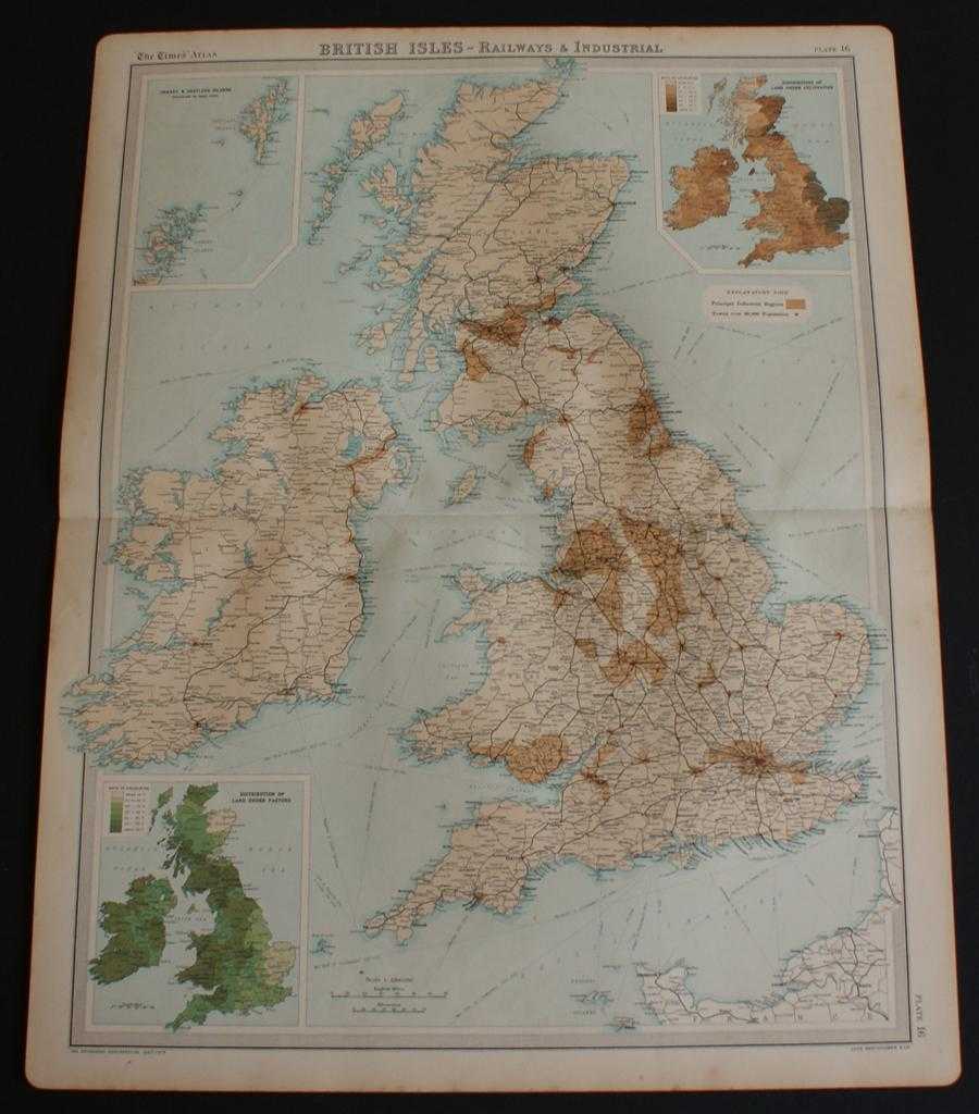
Title: Railways and Industrial Map of the British Isles from the 1920 Times Atlas (Plate 16) with inset maps showing Distribution of Land Under Pasture and Cultivation
Description: The Times, London, 1920. First Edition, Softcover. Very Good Condition/No Dust Jacket. Disbound single sheet with horizontal centre fold from the 1920 "The Times Survey Atlas of the World". Map is in colour and is suitable for framing. Map covers whole of British Isles at scale 1:2,000,000 with the Orkney and Shetland Islands included in an inset continuation panel. Map shows Principal Industrial Regions and towns with a population over 30,000 are highlighted. Railways are shown, as are shipping routes. Sheet contains two inset maps showing the distribution of land under cultivation and under pasture and are coloured by percentage band per county. Slightly darkened edges with occasional light foxing in the margins and very occasional light foxing to mapped area. Sheet is otherwise crisp and clean. Size: 58cm x 46cm approx. Quantity Available: 1. Shipped Weight: under 1 kg. Pictures of this item not already displayed here available upon request. Inventory No: 45020044022. ISBN: 0586044434
Keywords: BZDB4 Maps; countryside, farming, field sports, agriculture, horticulture; British History; Railways & railway engines. The Times and J. G. Bartholomew Railways and Industrial Map of the British Isles from the 1920 Times Atlas (Plate 16) with inset maps s
See more books from our catalog: Maps
Title: Railways and Industrial Map of the British Isles from the 1920 Times Atlas (Plate 16) with inset maps showing Distribution of Land Under Pasture and Cultivation
Description: The Times, London, 1920. First Edition, Softcover. Very Good Condition/No Dust Jacket. Disbound single sheet with horizontal centre fold from the 1920 "The Times Survey Atlas of the World". Map is in colour and is suitable for framing. Map covers whole of British Isles at scale 1:2,000,000 with the Orkney and Shetland Islands included in an inset continuation panel. Map shows Principal Industrial Regions and towns with a population over 30,000 are highlighted. Railways are shown, as are shipping routes. Sheet contains two inset maps showing the distribution of land under cultivation and under pasture and are coloured by percentage band per county. Slightly darkened edges with occasional light foxing in the margins and very occasional light foxing to mapped area. Sheet is otherwise crisp and clean. Size: 58cm x 46cm approx. Quantity Available: 1. Shipped Weight: under 1 kg. Pictures of this item not already displayed here available upon request. Inventory No: 45020044022. ISBN: 0586044434
Keywords: BZDB4 Maps; countryside, farming, field sports, agriculture, horticulture; British History; Railways & railway engines. The Times and J. G. Bartholomew Railways and Industrial Map of the British Isles from the 1920 Times Atlas (Plate 16) with inset maps s
Price: GBP 24.00 = appr. US$ 34.27 Seller: Bailgate Books Ltd
- Book number: 45020044022
- Book number: 45020044022
See more books from our catalog: Maps