Author: The Times and J. G. Bartholomew
Title: Map of "North Polar Regions" or the Arctic from 1920 Times Atlas (Plate 8)
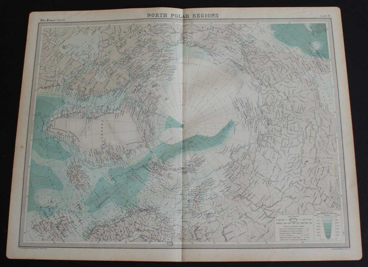
Description: The Times, London, 1920. First Edition, Softcover. Very Good Condition/No Dust Jacket. Disbound single sheet with vertical centre fold from the 1920 "The Times Survey Atlas of the World". Map is in colour and suitable for framing. Map at scale 1:14,000,000 with explanatory notes including Pack Ice,Explorers Routes with Dates and Current Arrows. Some of the area around the North Pole is marked "Unexplored Region" and so is not mapped in. Map covers Arctic Regions and includes the North Pole, Barents Sea, Kara Sea, Beaufort Sea, Greenland, Iceland, Spitsbergen, Franz Josef Land, Baffin Island, parts of Canada, Alaska, Siberia (Russia), Norway, Sweden and the UK, etc. Slightly darkened and very lightly creased edges with some occasional very light foxing in the margins. Sheet is otherwise crisp and clean. Size: 46 x 58cm approx. Quantity Available: 1. Shipped Weight: under 1 kg. Pictures of this item not already displayed here available upon request. Inventory No: 45020044017. ISBN: 0586044434
Keywords: BZDB4 Maps; naval, naval history, maritime, ships, boats; World History; Arctic & Antarctic. The Times and J. G. Bartholomew Map of "North Polar Regions" or the Arctic from 1920 Times Atlas (Plate 8) naval, naval history, maritime, ships, boats World Hist
See more books from our catalog: Maps
Title: Map of "North Polar Regions" or the Arctic from 1920 Times Atlas (Plate 8)
Description: The Times, London, 1920. First Edition, Softcover. Very Good Condition/No Dust Jacket. Disbound single sheet with vertical centre fold from the 1920 "The Times Survey Atlas of the World". Map is in colour and suitable for framing. Map at scale 1:14,000,000 with explanatory notes including Pack Ice,Explorers Routes with Dates and Current Arrows. Some of the area around the North Pole is marked "Unexplored Region" and so is not mapped in. Map covers Arctic Regions and includes the North Pole, Barents Sea, Kara Sea, Beaufort Sea, Greenland, Iceland, Spitsbergen, Franz Josef Land, Baffin Island, parts of Canada, Alaska, Siberia (Russia), Norway, Sweden and the UK, etc. Slightly darkened and very lightly creased edges with some occasional very light foxing in the margins. Sheet is otherwise crisp and clean. Size: 46 x 58cm approx. Quantity Available: 1. Shipped Weight: under 1 kg. Pictures of this item not already displayed here available upon request. Inventory No: 45020044017. ISBN: 0586044434
Keywords: BZDB4 Maps; naval, naval history, maritime, ships, boats; World History; Arctic & Antarctic. The Times and J. G. Bartholomew Map of "North Polar Regions" or the Arctic from 1920 Times Atlas (Plate 8) naval, naval history, maritime, ships, boats World Hist
Price: GBP 24.00 = appr. US$ 34.27 Seller: Bailgate Books Ltd
- Book number: 45020044017
- Book number: 45020044017
See more books from our catalog: Maps