Author: The Times and J. G. Bartholomew
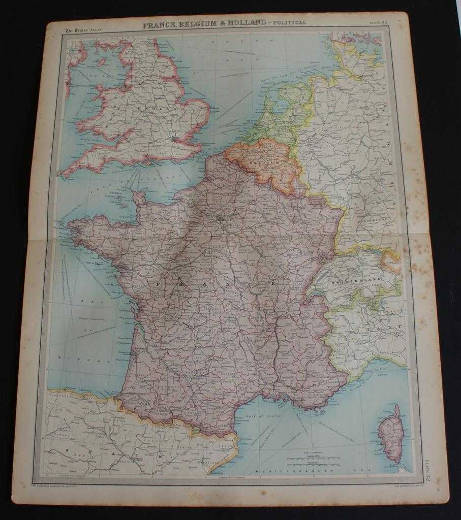
Title: Map of France, Belgium, Holland, England, Wales, Switzerland, Andorra and Luxemburg from 1920 Times Atlas (Plate 32 "France, Belgium & Holland - Political") with Corsica, Channel Islands and parts of Germany, Italy and Spain
Description: The Times, London, 1920. First Edition, Softcover. Good Condition/No Dust Jacket. Disbound single sheet with horizontal centre fold from the 1920 "The Times Survey Atlas of the World". Map is in colour and suitable for framing. Colour is according to country, France, Belgium and Holland are fully coloured, others only have coloured borders. Map at scale 1:3,000,000. Map covers France, Belgium, Holland, England, Wales, Switzerland (almost all), Andorra, Luxemburg, Corsica, Channel Islands, Isle of Man, Liechtenstein and parts of Germany, Italy, Spain, Scotland, Ireland and Denmark. Slightly darkened and worn edges with some light foxing in the margins and heavier foxing along the right hand edge which extends slightly into the mapped area. Sheet is otherwise crisp, clean and bright. Size: 58cm x 46cm approx. Quantity Available: 1. Shipped Weight: under 1 kg. Pictures of this item not already displayed here available upon request. Inventory No: 45020044013. ISBN: 0586044434
Keywords: BZDB4 Maps; British History; Germany, Austria, Switzerland and German Language; France and French Language. The Times and J. G. Bartholomew Map of France, Belgium, Holland, England, Wales, Switzerland, Andorra and Luxemburg from 1920 Times Atlas (Plate 32
See more books from our catalog: Maps
Title: Map of France, Belgium, Holland, England, Wales, Switzerland, Andorra and Luxemburg from 1920 Times Atlas (Plate 32 "France, Belgium & Holland - Political") with Corsica, Channel Islands and parts of Germany, Italy and Spain
Description: The Times, London, 1920. First Edition, Softcover. Good Condition/No Dust Jacket. Disbound single sheet with horizontal centre fold from the 1920 "The Times Survey Atlas of the World". Map is in colour and suitable for framing. Colour is according to country, France, Belgium and Holland are fully coloured, others only have coloured borders. Map at scale 1:3,000,000. Map covers France, Belgium, Holland, England, Wales, Switzerland (almost all), Andorra, Luxemburg, Corsica, Channel Islands, Isle of Man, Liechtenstein and parts of Germany, Italy, Spain, Scotland, Ireland and Denmark. Slightly darkened and worn edges with some light foxing in the margins and heavier foxing along the right hand edge which extends slightly into the mapped area. Sheet is otherwise crisp, clean and bright. Size: 58cm x 46cm approx. Quantity Available: 1. Shipped Weight: under 1 kg. Pictures of this item not already displayed here available upon request. Inventory No: 45020044013. ISBN: 0586044434
Keywords: BZDB4 Maps; British History; Germany, Austria, Switzerland and German Language; France and French Language. The Times and J. G. Bartholomew Map of France, Belgium, Holland, England, Wales, Switzerland, Andorra and Luxemburg from 1920 Times Atlas (Plate 32
Price: GBP 22.00 = appr. US$ 31.42 Seller: Bailgate Books Ltd
- Book number: 45020044013
- Book number: 45020044013
See more books from our catalog: Maps