Author: The Times and J. G. Bartholomew
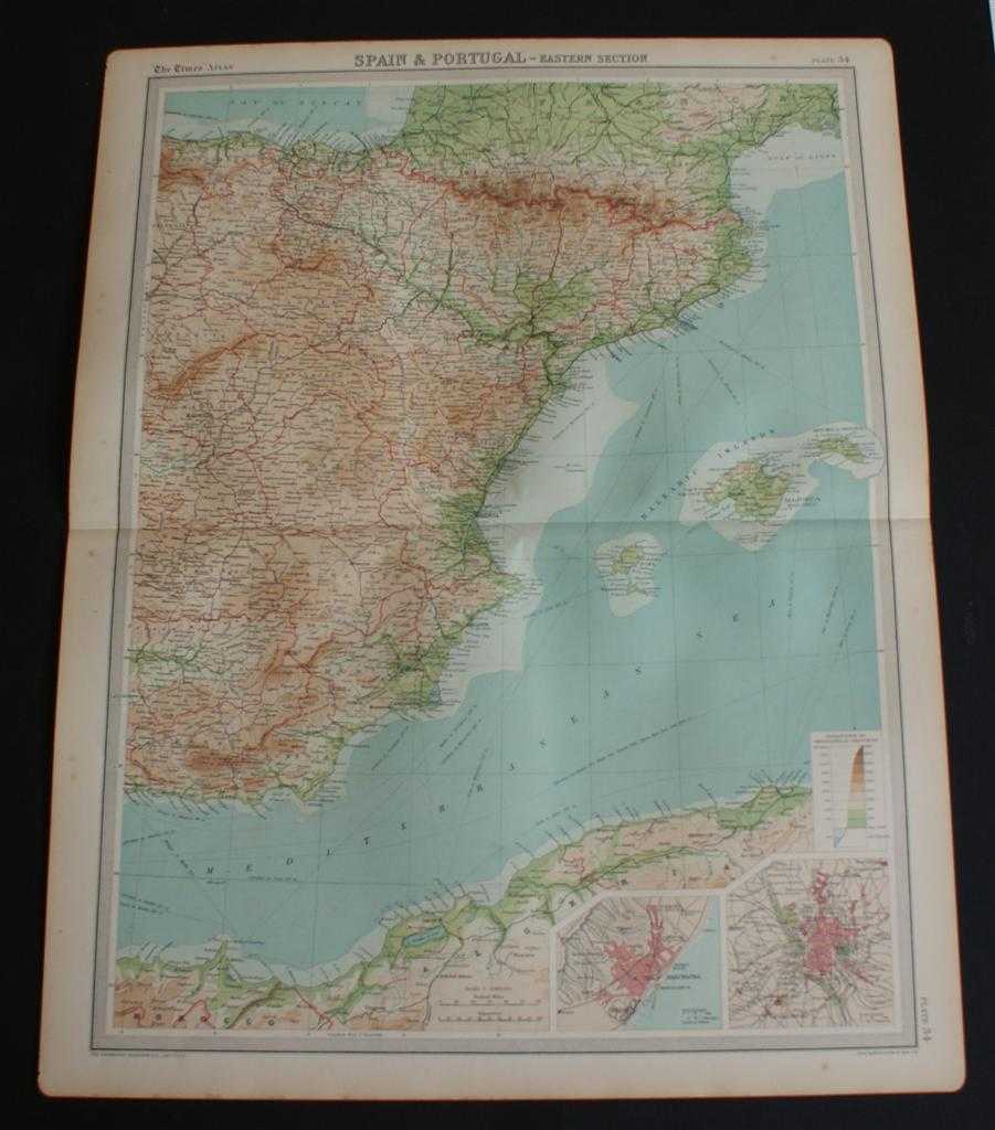
Title: Map of Eastern Spain including the Pyrenees, Andorra and the Balearic Islands from 1920 Times Atlas (Plate 34 "Spain & Portugal - Eastern Section") with inset plans of Barcelona and Madrid
Description: The Times, London, 1920. First Edition, Softcover. Very Good Condition/No Dust Jacket. Disbound single sheet with horizontal centre fold from the 1920 "The Times Survey Atlas of the World". Map is in colour and suitable for framing. Colour is according to contour, boundaries of provinces and countries are in red. Map at scale 1:2,000,000 with small inset plans of Barcelona and Madrid. Map covers eastern provinces of Spain, Andorra, Majorca, Minorca, Iviza and parts of France, Morocco and Algeriao. Included are Madrid, Granada, Valencia, Barcelona, Cartagena, Alicante, Murcia, Saragossa, Bilbao, Santander, Pamplona, Palma, S Sebastian, Toulouse, Nimes, Montpellier, Oran, Alger, etc. Slightly darkened edges with occasional light foxing in the margins. Edges are slightly roughened at the left side corners but sheet is otherwise crisp, clean and bright. Size: 58cm x 46cm approx. Quantity Available: 1. Shipped Weight: under 1 kg. Pictures of this item not already displayed here available upon request. Inventory No: 45020044012. ISBN: 0586044434
Keywords: BZDB4 Maps; Africa; France and French Language; Spain and Portugal, Spanish & Portuguese Language. The Times and J. G. Bartholomew Map of Eastern Spain including the Pyrenees, Andorra and the Balearic Islands from 1920 Times Atlas (Plate 34 "Spain & Portu
See more books from our catalog: Maps
Title: Map of Eastern Spain including the Pyrenees, Andorra and the Balearic Islands from 1920 Times Atlas (Plate 34 "Spain & Portugal - Eastern Section") with inset plans of Barcelona and Madrid
Description: The Times, London, 1920. First Edition, Softcover. Very Good Condition/No Dust Jacket. Disbound single sheet with horizontal centre fold from the 1920 "The Times Survey Atlas of the World". Map is in colour and suitable for framing. Colour is according to contour, boundaries of provinces and countries are in red. Map at scale 1:2,000,000 with small inset plans of Barcelona and Madrid. Map covers eastern provinces of Spain, Andorra, Majorca, Minorca, Iviza and parts of France, Morocco and Algeriao. Included are Madrid, Granada, Valencia, Barcelona, Cartagena, Alicante, Murcia, Saragossa, Bilbao, Santander, Pamplona, Palma, S Sebastian, Toulouse, Nimes, Montpellier, Oran, Alger, etc. Slightly darkened edges with occasional light foxing in the margins. Edges are slightly roughened at the left side corners but sheet is otherwise crisp, clean and bright. Size: 58cm x 46cm approx. Quantity Available: 1. Shipped Weight: under 1 kg. Pictures of this item not already displayed here available upon request. Inventory No: 45020044012. ISBN: 0586044434
Keywords: BZDB4 Maps; Africa; France and French Language; Spain and Portugal, Spanish & Portuguese Language. The Times and J. G. Bartholomew Map of Eastern Spain including the Pyrenees, Andorra and the Balearic Islands from 1920 Times Atlas (Plate 34 "Spain & Portu
Price: GBP 24.00 = appr. US$ 34.27 Seller: Bailgate Books Ltd
- Book number: 45020044012
- Book number: 45020044012
See more books from our catalog: Maps