Author: The Times and J. G. Bartholomew
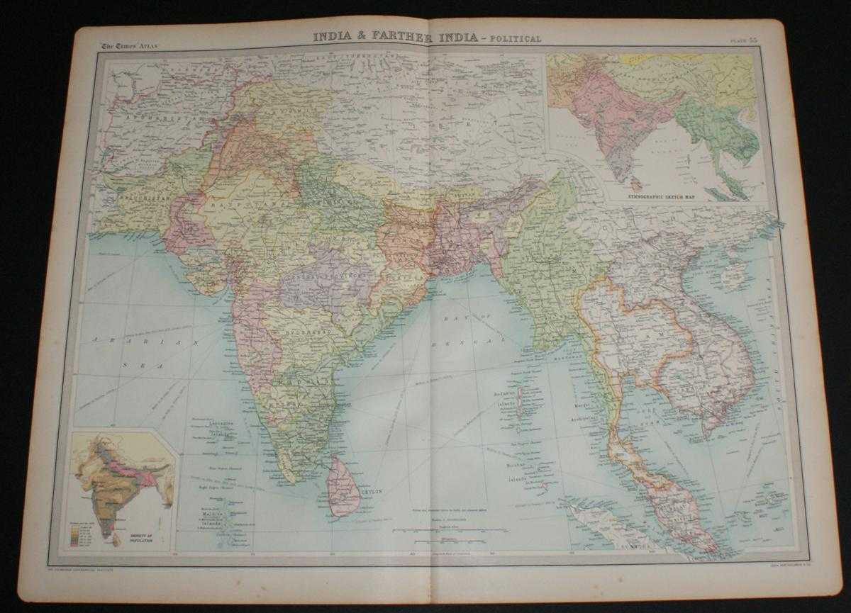
Title: Map of "India & Farther India" from the 1920 Times Survey Atlas (Plate 55) covering modern day India, Pakistan, Afghanistan, Nepal, Tibet, Thailand, Bangladesh, Myanmar, Cambodia, Laos, Vietnam, Sri Lanka and Malaysia
Description: Map The Times, London, 1920. First Edition, Softcover. Very Good Condition/No Dust Jacket. Disbound single sheet with vertical centre fold from the 1920 "The Times Survey Atlas of the World". Map is in colour and suitable for framing. Country or state boundaries are marked in different colours with some colour infill, seas are coloured blue. Map at scale 1:10,000,000 with two inset maps showing Ethnic and Population Density data. Map covers modern day India, Pakistan (Baluchistan), Afghanistan, Nepal, Tibet, Thailand (Siam), Bangladesh, Myanmar (Burma), Cambodia, Laos, Bhutan, Vietnam (Annam), Sri Lanka (Ceylon), Malaysia, Andaman, Nicobar, Maldive and Laccadive Islands, etc. Slightly darkened edges with occasional foxing in margins, sheet is otherwise clean and crisp. Item Type: Map. Single sheet map/chart which is suitable for framing and will be shipped rolled and in a cardboard tube. Quantity Available: 1. Shipped Weight: under 1 kg. Pictures of this item not already displayed here available upon request. Inventory No: 45020034041. ISBN: 0850335086
Keywords: BZDB4 Maps; China, Japan, Nepal & Tibet; World History; Indian sub-continent & South East Asia. The Times and J. G. Bartholomew Map of "India & Farther India" from the 1920 Times Survey Atlas (Plate 55) covering modern day India, Pakistan, Afghanistan, Ne
See more books from our catalog: Maps
Title: Map of "India & Farther India" from the 1920 Times Survey Atlas (Plate 55) covering modern day India, Pakistan, Afghanistan, Nepal, Tibet, Thailand, Bangladesh, Myanmar, Cambodia, Laos, Vietnam, Sri Lanka and Malaysia
Description: Map The Times, London, 1920. First Edition, Softcover. Very Good Condition/No Dust Jacket. Disbound single sheet with vertical centre fold from the 1920 "The Times Survey Atlas of the World". Map is in colour and suitable for framing. Country or state boundaries are marked in different colours with some colour infill, seas are coloured blue. Map at scale 1:10,000,000 with two inset maps showing Ethnic and Population Density data. Map covers modern day India, Pakistan (Baluchistan), Afghanistan, Nepal, Tibet, Thailand (Siam), Bangladesh, Myanmar (Burma), Cambodia, Laos, Bhutan, Vietnam (Annam), Sri Lanka (Ceylon), Malaysia, Andaman, Nicobar, Maldive and Laccadive Islands, etc. Slightly darkened edges with occasional foxing in margins, sheet is otherwise clean and crisp. Item Type: Map. Single sheet map/chart which is suitable for framing and will be shipped rolled and in a cardboard tube. Quantity Available: 1. Shipped Weight: under 1 kg. Pictures of this item not already displayed here available upon request. Inventory No: 45020034041. ISBN: 0850335086
Keywords: BZDB4 Maps; China, Japan, Nepal & Tibet; World History; Indian sub-continent & South East Asia. The Times and J. G. Bartholomew Map of "India & Farther India" from the 1920 Times Survey Atlas (Plate 55) covering modern day India, Pakistan, Afghanistan, Ne
Price: GBP 26.00 = appr. US$ 37.13 Seller: Bailgate Books Ltd
- Book number: 45020034041
- Book number: 45020034041
See more books from our catalog: Maps