Author: The Times and J. G. Bartholomew
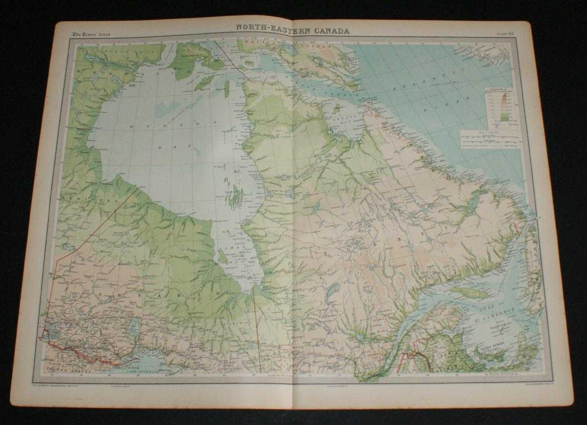
Title: Map of North-Eastern Canada from the 1920 Times Survey Atlas (Plate 83) including Ontario, Quebec, Labrador, Hudson Bay and Gulf of St. Lawrence
Description: Map The Times, London, 1920. First Edition, Softcover. Very Good Condition/No Dust Jacket. Disbound single sheet with vertical centre fold from the 1920 "The Times Survey Atlas of the World". Map is in colour and suitable for framing. Colour on both land and sea according to contour. Map at scale 1:5,000,000. Map covers; Ontario, Quebec, Labrador, parts of Keewatin, Manitoba, Baffin Island, Newfoundland and New Brunswick, also Hudson Bay, James Bay, Ungava Bay, Gulf of St. Lawrence, Prince Edward Island, etc. Slightly darkened edges with occasional light foxing in margins but sheet is otherwise clean and crisp. Item Type: Map. Single sheet map/chart which is suitable for framing and will be shipped rolled and in a cardboard tube. Quantity Available: 1. Shipped Weight: under 1 kg. Pictures of this item not already displayed here available upon request. Inventory No: 45020034024. ISBN: 0850335086
Keywords: BZDB4 Maps; World History; USA & Canada. The Times and J. G. Bartholomew Map of North-Eastern Canada from the 1920 Times Survey Atlas (Plate 83) including Ontario, Quebec, Labrador, Hudson Bay and Gulf of St. Lawrence World History USA & Canada
See more books from our catalog: Maps
Title: Map of North-Eastern Canada from the 1920 Times Survey Atlas (Plate 83) including Ontario, Quebec, Labrador, Hudson Bay and Gulf of St. Lawrence
Description: Map The Times, London, 1920. First Edition, Softcover. Very Good Condition/No Dust Jacket. Disbound single sheet with vertical centre fold from the 1920 "The Times Survey Atlas of the World". Map is in colour and suitable for framing. Colour on both land and sea according to contour. Map at scale 1:5,000,000. Map covers; Ontario, Quebec, Labrador, parts of Keewatin, Manitoba, Baffin Island, Newfoundland and New Brunswick, also Hudson Bay, James Bay, Ungava Bay, Gulf of St. Lawrence, Prince Edward Island, etc. Slightly darkened edges with occasional light foxing in margins but sheet is otherwise clean and crisp. Item Type: Map. Single sheet map/chart which is suitable for framing and will be shipped rolled and in a cardboard tube. Quantity Available: 1. Shipped Weight: under 1 kg. Pictures of this item not already displayed here available upon request. Inventory No: 45020034024. ISBN: 0850335086
Keywords: BZDB4 Maps; World History; USA & Canada. The Times and J. G. Bartholomew Map of North-Eastern Canada from the 1920 Times Survey Atlas (Plate 83) including Ontario, Quebec, Labrador, Hudson Bay and Gulf of St. Lawrence World History USA & Canada
Price: GBP 26.00 = appr. US$ 37.13 Seller: Bailgate Books Ltd
- Book number: 45020034024
- Book number: 45020034024
See more books from our catalog: Maps