Author: The Times and J. G. Bartholomew
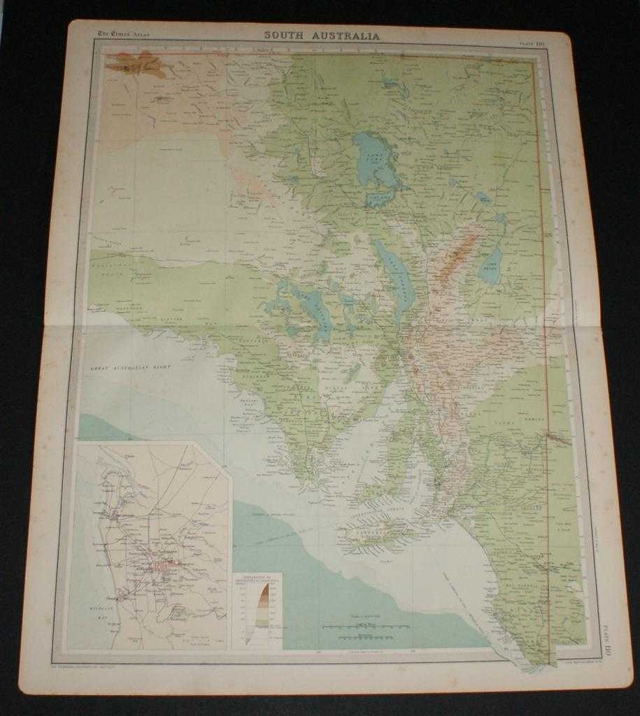
Title: Map of South Australia from the 1920 Times Survey Atlas (Plate 110) including inset map of Adelaide and Environs
Description: Map The Times, London, 1920. First Edition, Softcover. Very Good Condition/No Dust Jacket. Disbound single sheet with horizontal centre fold from the 1920 "The Times Survey Atlas of the World". Map is in colour and suitable for framing. Colour on both land and sea according to contour. Map at scale 1:2,500,000 with inset of Adelaide at larger scale. Area covered includes: Lake Eyre, Lake Torrens, Lake Frome, Lake Gairdner, Spencer Gulf, Carnarvon or Kangaroo Island, Gulf of St. Vincent, Adelaide, Stuarts Range, etc. Slightly darkened edges, sheet some foxing in the margins and has occasional light foxing in the mapped area but is otherwise clean and crisp. Item Type: Map. Single sheet map/chart which is suitable for framing and will be shipped rolled and in a cardboard tube. Quantity Available: 1. Shipped Weight: under 1 kg. Pictures of this item not already displayed here available upon request. Inventory No: 45020034003. ISBN: 0850335086
Keywords: BZDB4 Maps; naval, naval history, maritime, ships, boats; World History; Australasia and the Pacific. The Times and J. G. Bartholomew Map of South Australia from the 1920 Times Survey Atlas (Plate 110) including inset map of Adelaide and Environs naval, n
See more books from our catalog: Maps
Title: Map of South Australia from the 1920 Times Survey Atlas (Plate 110) including inset map of Adelaide and Environs
Description: Map The Times, London, 1920. First Edition, Softcover. Very Good Condition/No Dust Jacket. Disbound single sheet with horizontal centre fold from the 1920 "The Times Survey Atlas of the World". Map is in colour and suitable for framing. Colour on both land and sea according to contour. Map at scale 1:2,500,000 with inset of Adelaide at larger scale. Area covered includes: Lake Eyre, Lake Torrens, Lake Frome, Lake Gairdner, Spencer Gulf, Carnarvon or Kangaroo Island, Gulf of St. Vincent, Adelaide, Stuarts Range, etc. Slightly darkened edges, sheet some foxing in the margins and has occasional light foxing in the mapped area but is otherwise clean and crisp. Item Type: Map. Single sheet map/chart which is suitable for framing and will be shipped rolled and in a cardboard tube. Quantity Available: 1. Shipped Weight: under 1 kg. Pictures of this item not already displayed here available upon request. Inventory No: 45020034003. ISBN: 0850335086
Keywords: BZDB4 Maps; naval, naval history, maritime, ships, boats; World History; Australasia and the Pacific. The Times and J. G. Bartholomew Map of South Australia from the 1920 Times Survey Atlas (Plate 110) including inset map of Adelaide and Environs naval, n
Price: GBP 22.00 = appr. US$ 31.42 Seller: Bailgate Books Ltd
- Book number: 45020034003
- Book number: 45020034003
See more books from our catalog: Maps